
![]()
|
FUNNEL
F0001
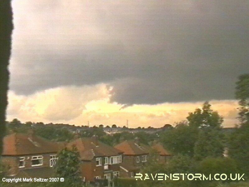
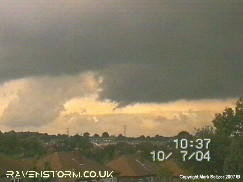
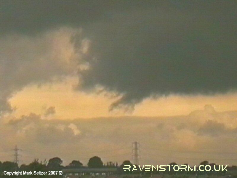
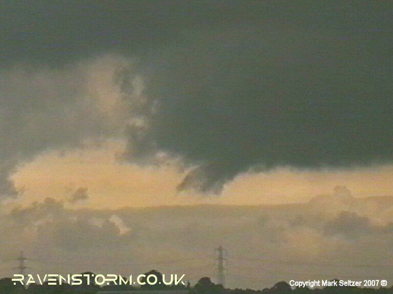
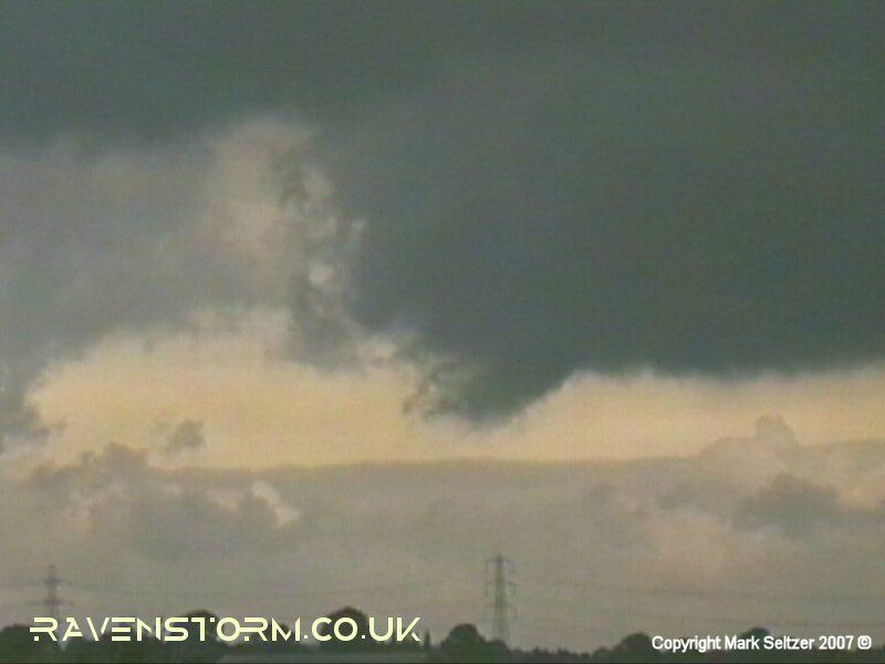
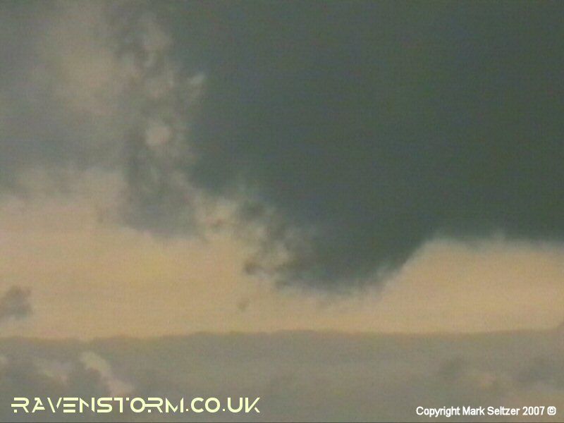
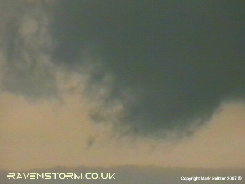
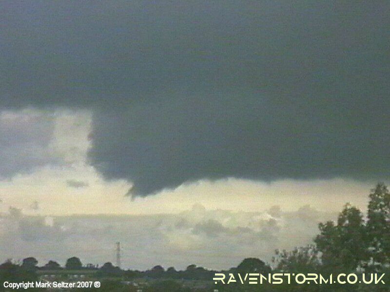
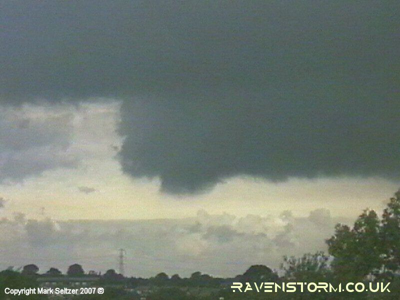
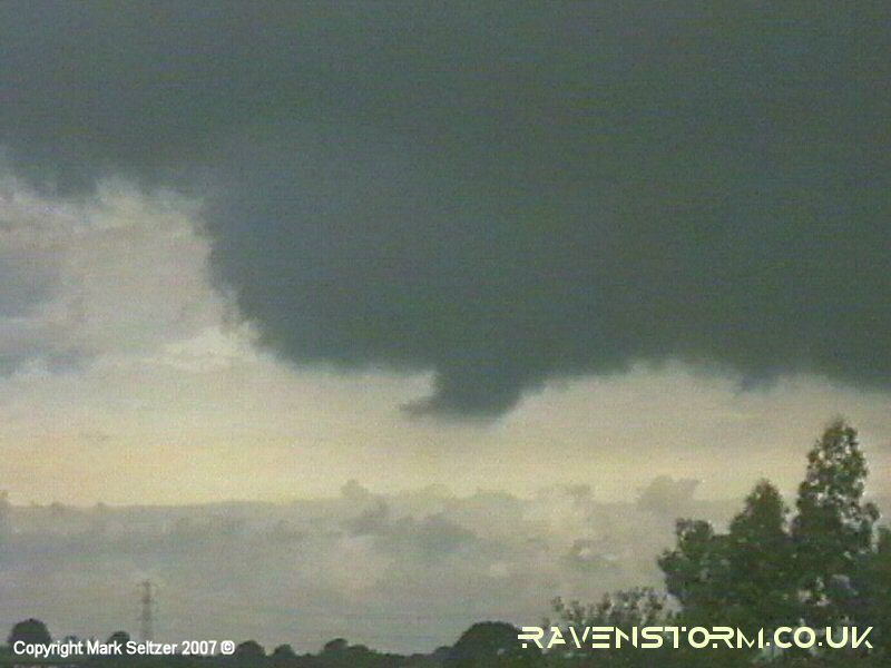
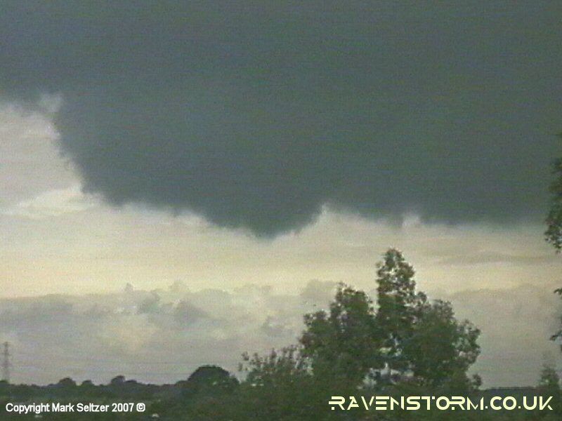
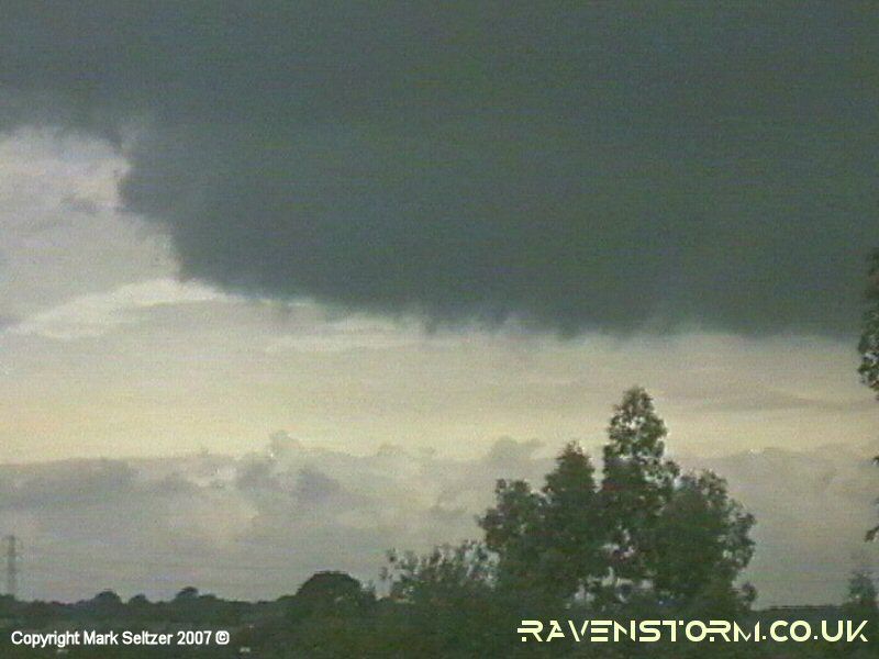
I spotted some mesocyclonic activity to the northwest of Macclesfield in a similar location as the tornadoes of T0014 and T0027 (might be the "Cheshire Gap" effect encouraging this location!). The synoptics were similar to T0014 as well, only drier and warmer. The cloud base actually took the form of a classic supercell in rotation mode - the "horseshoe" clearance approaching from the left, and the mesocyclone hang-back just northeast of it with a rotating dangly bit under that. The "horseshoe", according to US Midwest chasing circles, is renowned for being a precursor to a tornado and is evidenced well in proper supercells.
The dangly bit
(small scud funnel of sorts) is the main focus of this footage, which upon
time-lapsing turned out to be rotating into the updraught. The lowered condensation point
was likely caused by cooler air
being sucked back into the updraught, indicative of tornadic genesis. The rotation
was slow, barely visible in real-time, but as mentioned it is better
evidenced in the timelapse (video above). This vortex is exactly where one would expect
a tornado to
emerge if vorticity was stretched enough. No thunder or lightning activity was observed from my perspective, but may have been downstream. This is also common in sheared supercells not to see much lightning activity around the mesocyclone itself, let alone several miles south of it.
|

© Mark Seltzer
www.electricsky.co.uk