THUNDERSTORM T0002 Date: Friday 7th June 1996
Time: 20:45 BST Location:
Macclesfield, Cheshire UK Path: Overhead moving northwards
Synoptics: Continental Plume Duration: ~ 3 hours Type: Multicells Average lightning type: Cloud-to-cloud / Cloud-to-ground
Average discharge rate: Unknown Footage Quality: None
T0002 consisted of several large continental plume cells
pulsating northwards across much of the country, with areas such as
Macclesfield getting hit again and again one after the other. Occurring at
night-time made them more spectacular and had a total duration of about 3
hours from my perspective. Still not having a video camera in my possession, I audio-taped
the thunder and captured a few good ones including a couple of crashers from
close CGs near the rear of the cells (classic for forward-sloping mid-level
storms). The storms cleared the
area at about midnight. Obviously I only audio-taped the peak of the activity
when it got close, however after three hours of watching I then got bored of
the distant flickers and went to bed. This would have been a good one to film.
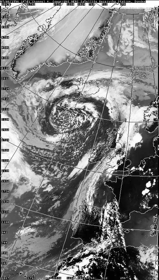
Looking at satellite imagery below the storms were a result of a classic
continental plume (or likely Spanish Plume) being dragged north and
destabilising against the advancing Atlantic trough. You can see the surface
heat - even at 02:15UTC, Over France and Germany. Looking at the
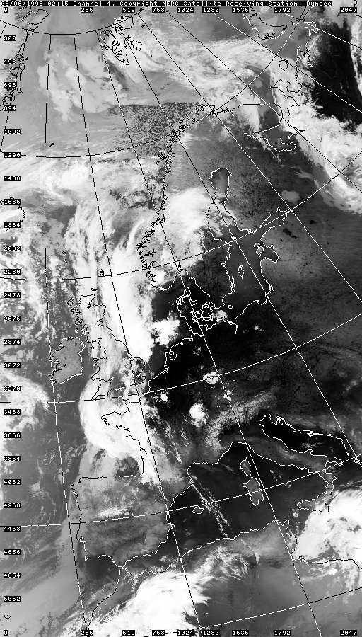
02:15 IR image it is clear that there were large amounts of
convective activity running in a line up the country, now across the North
Sea at 02:15UTC, pointing to a widespread UK outbreak.
By this time another "cut-off low" appears to have formed in the Bay of
Biscay.
