|
THUNDERSTORM T0018
Date: Wednesday 9th September 1998 Time:
1230BST (1303BST for CG)
Location:
Macclesfield, Cheshire UK
Path: Overhead, travelling northeast
Synoptics:
Returning polar/arctic maritime airmass near centre of deep
low
Duration: 35 minutes
Type: Open-cell Multicell
Average lightning type: C-G
Average discharge rate: n/a (no footage taken)
Footage Quality: None
I was at school during the passing this storm, so there is no
photogenic footage unless I draw a sketch. The
only reason I kept a log of it here is, at the
time, I wanted to log every storm that had
happened in Macclesfield that year. I could delete it now but it would mess
up the sequence of the proceeding storm numbers.
In fact, I had set the camera up at home ready to film as I was expecting
a storm risk given the late-summer returning polar maritime airmass, heavily
unstable with long-land track to Macclesfield. The hope was that a swift phone call
to mother at home would have the camera switched on at the right moment,
however the phones at school were out of order and only the extreme
privileged had a mobile phone! So I stood under shelter from the splintering rain
watching it with my friends. There was actually no lightning activity until the rain
had stopped and it had trundled off. The first thunder to be
heard was a substantial bass-boom that sounded crisp and clear without the
noise of the rain. At that point the inevitable happened and everyone who
was stood outside cheered in unison. Everyone loves a thunderstorm, glad it
isn't just me...!
At that point I started watching it as it went off into the distance. A
distant C-G struck from the backside of the storm where there were a few
strong towers in development, which in turn gave another
distant thunder. Other
cells were visible around it to the
NW
and SE, all of which appeared to be sharing the same anvil.
The torrential rain almost flooded the school again, as T0014 did in June,
but not quite. If it had rained much longer at the same intensity it would
have been close. There was also a mini tornado reported in south Derbyshire
today on the news.
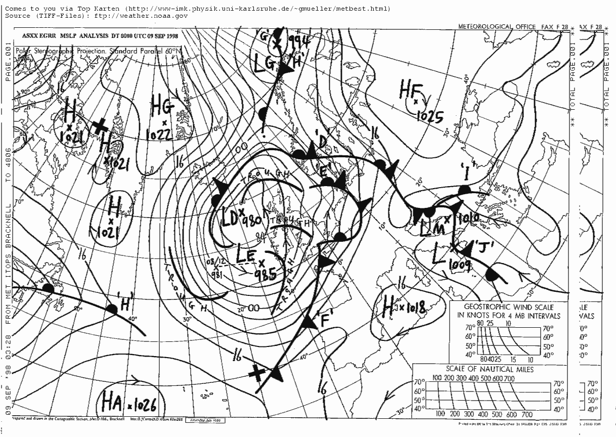
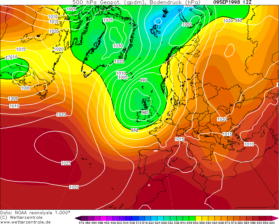
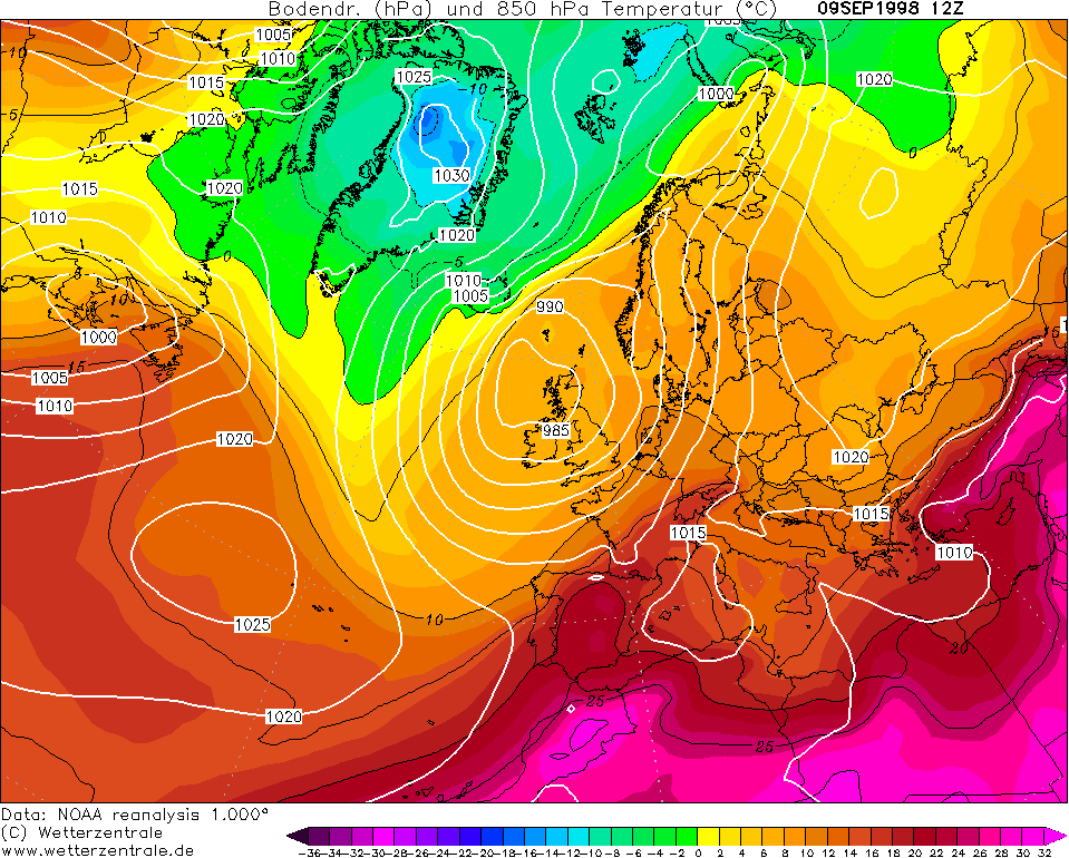
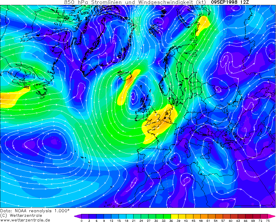
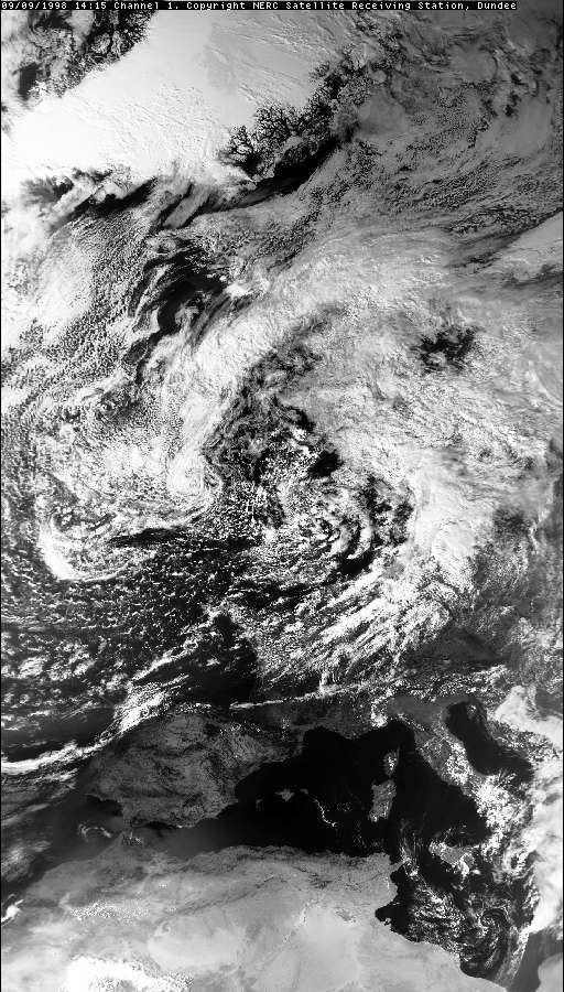
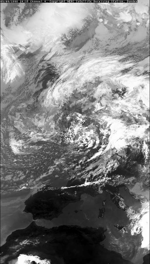
Synoptic Analysis
The showers in the were associated with an active trough hanging from a parent Low,
post-cold front in the returning polar (or even arctic) maritime air. The
low was deep at 980mb with a dart-board isobar pattern. All this suggests the air over the UK would have been
easily unstable to both September-sea (warmest seas) and land temperatures.
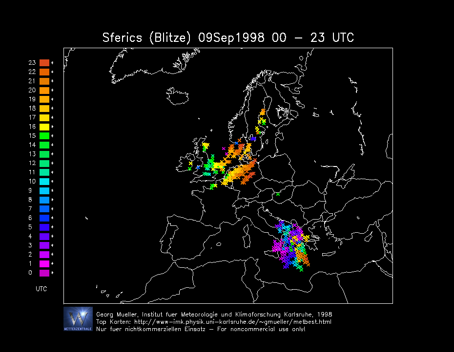
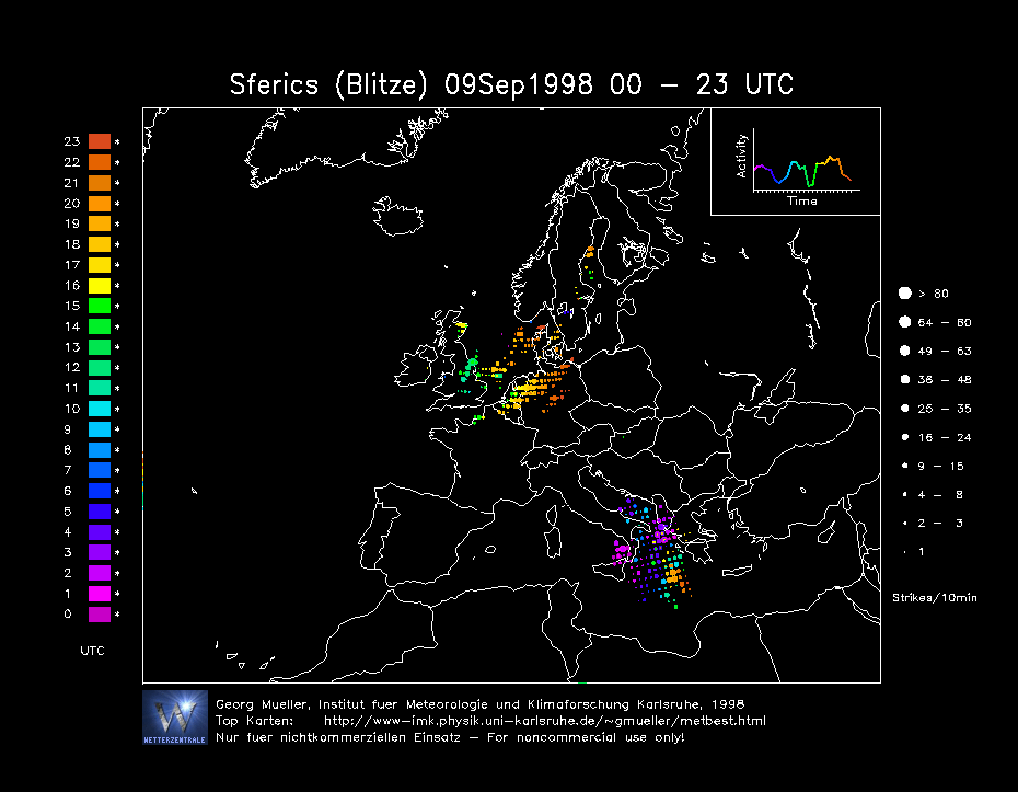
However, the Sferic diagrams indicate it was only the land-generated showers
which were unstable enough to produce thunder, as the strikes were largely
inland and east of the country.
CHARTS
(Credits)
SFERICS (Credits)
SATELLITE IMAGES (Credits)
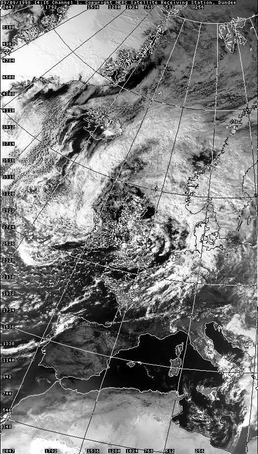
VISIBLE 09.09.1998 14:15
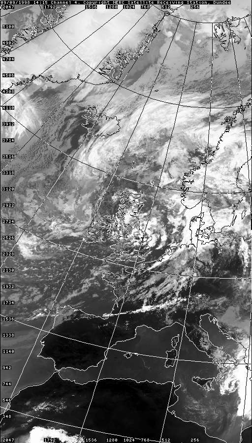
INFRARED 09.09.1998 14:15
VISIBLE 09.09.1998 14:15 + Grid
INFRARED 09.09.1998 14:15 + Grid
|
