|
THUNDERSTORM T0055
Date: Sunday 19th June 2005
Time:
approx 1500-1800 BST
Location:
Macclesfield, Cheshire UK
Path: Likely overhead, travelling NE
Synoptics:
Continental Plume, strongly surface heated and destabilised
in proximity of trough
Type: Surface-based linear Multicells, possible embedded Supercells
(unknown but correct environment)
Footage Quality: None
This outbreak was one of the most aggressive
thunderstorm squall-lines the northwest region has seen in years, and an
excellent example of when all the right ingredients come together in the
atmosphere to generate a severe thunderstorm. Unfortunately, I missed it by an
hour or two as I was arriving back from the south of England at the time. However
the cumulonimbus towers reached such heights I could see them from Reading
as I set off somewhat 170 miles away. They were enormous, likely hitting
-55C tops, and were developing
rapidly with large CAPE values.
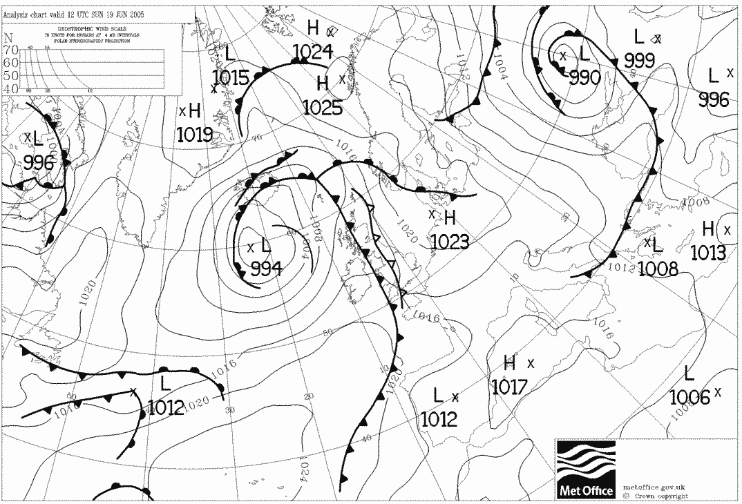
Weather situation
All the right atmospheric ingredients came
together on this day. The fuel
was there with high wet-bulb potential temperature values (WBPT) existing
over England by advection from the continent (plume), with the boundary
layer heating strongly below it by the Sun. A long-wave upper trough
associated with an approaching Atlantic depression advanced into this air
mass, just enough to focus development in the north and west of the plume
(linear development). A slight inversion
likely existed above the boundary layer which increased CAPE (Convective Available Potential Energy) values. All that was required was some
form of initiation to set it all off, which judging by the fact the cells
appeared to be strongest to the east of high ground in satellite imagery,
may have been some form of surface convergence or lee-low.
Large
cumulus fields were already forming in the North Midlands and Yorkshire areas
by midday as the daytime heating started hurtling
towards the 30s, showing that radiative (sensible) heating alone was enough
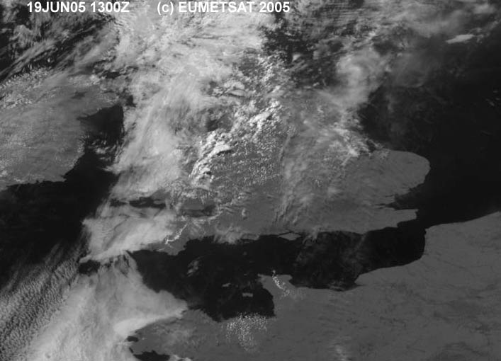
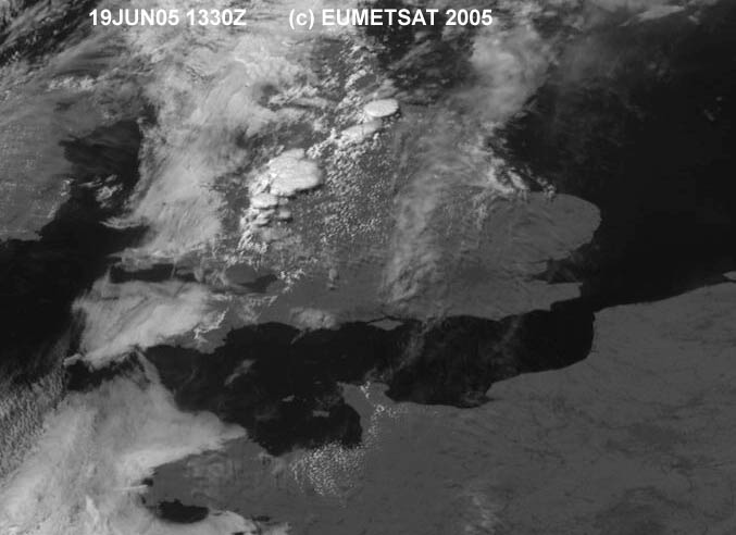
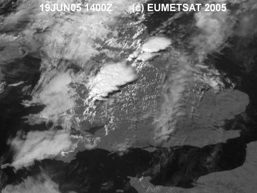
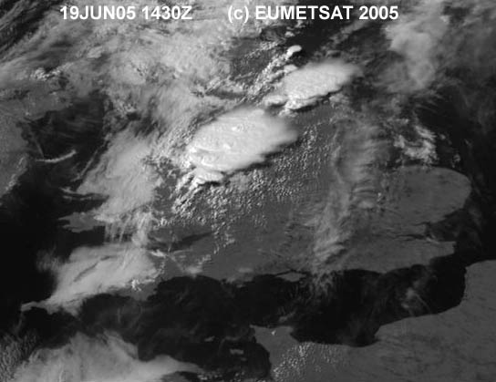
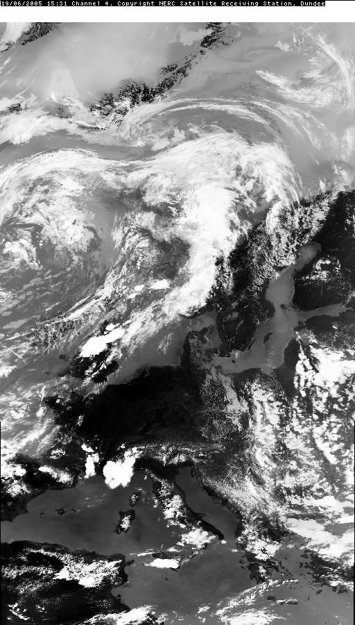
to start destabilising the atmosphere. As the satellite imagery shows, the
cap-breaking up-scaling convection started forming in these fields by
1400BST.
What I witnessed
By the time I had driven closer to the
development, now lying in a line across much of the North Midlands and
Yorkshire, the cloud base was visible and very ominous-looking with deformed
stratus rolls and very dark rain curtains. As I approached Congleton it
wasn’t raining a great deal, however the roads were completely flooded with
fountains of water spewing out of the drains, so the storm must have just
gone through before I arrived. Distant thunders were still rumbling away to the
east with the odd distant flash of sheet lightning occurring. By the time I
got back to Macclesfield the storm was long gone and only a few distant
rumbles were heard from the east.
Accounts of the ferocity of the storm system were soon spoken on the news
with power outages, widespread flooding, golf ball hail and even a few
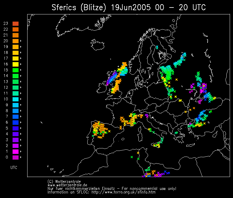
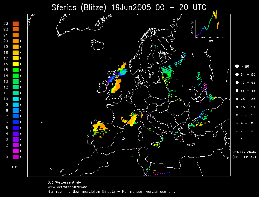
lightning injuries from tremendous intensities of C-G. These intensities
were reflected in Wetterzentrale’s lightning “sferics” charts at the time
(C-G strikes detection).
APPEAL: If anyone has any footage, photos or eyewitness
accounts of these storms to share on this page (credited to yourselves of course) I would be more than
happy to display them.
Links relating to this thunderstorm outbreak:
http://news.bbc.co.uk/1/hi/uk/4107890.stm
http://www.bbc.co.uk/northyorkshire/news/2005/flood/storm_gallery/01.shtml
http://www.bbc.co.uk/northyorkshire/news/2005/flood/stories/devastation.shtml
http://www.torro.org.uk/torro/publications/Review2005Thu.php
http://www.wiseweather.co.uk/id100.html
SATELLITE IMAGES (Credits)
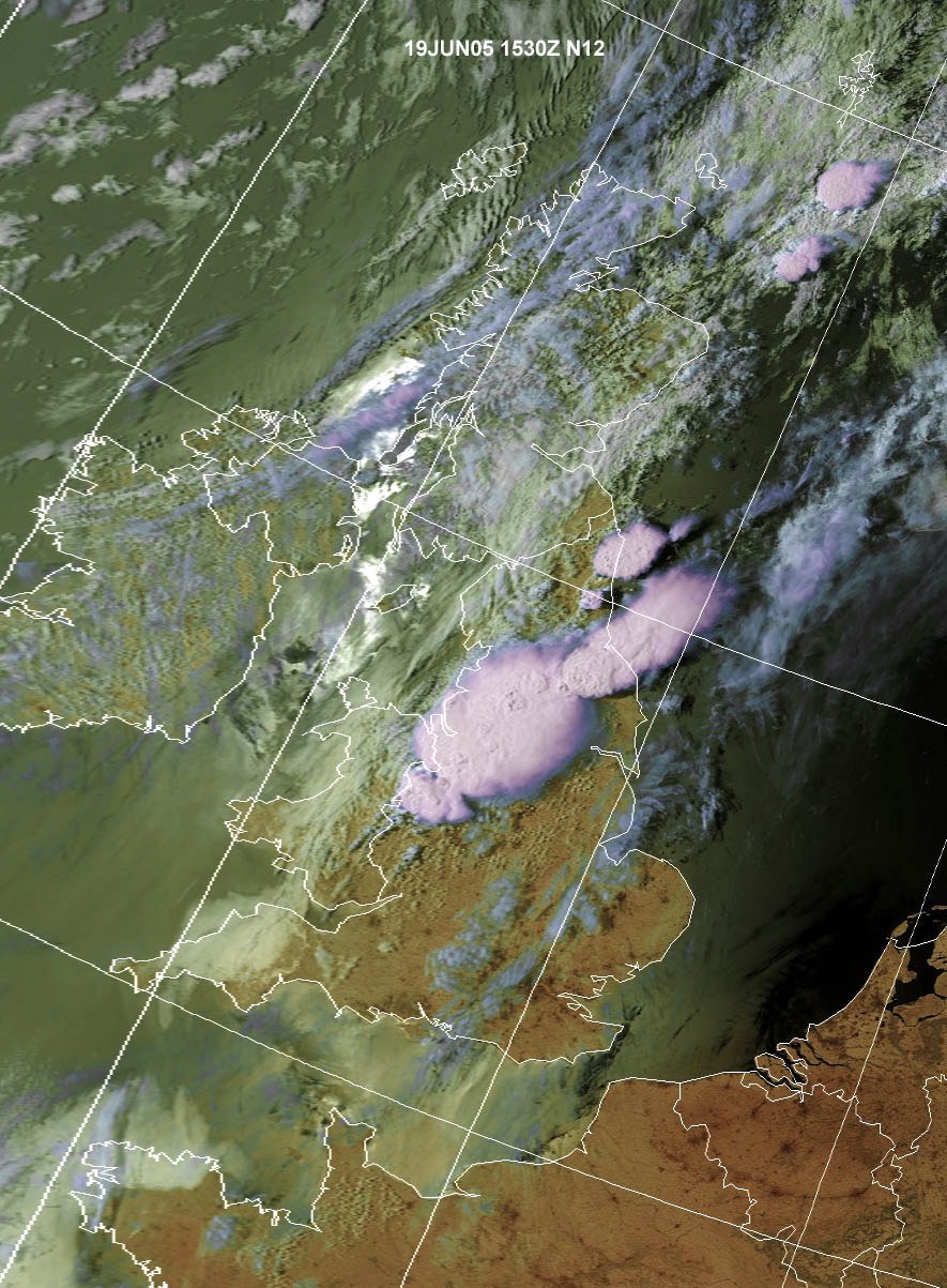
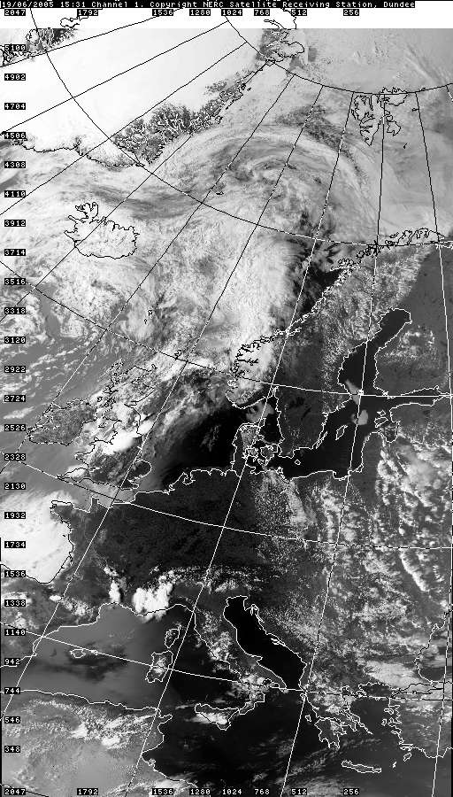
VISIBLE 19.06.2005 15:31
VISIBLE 19.06.2005 15:31 + Grid
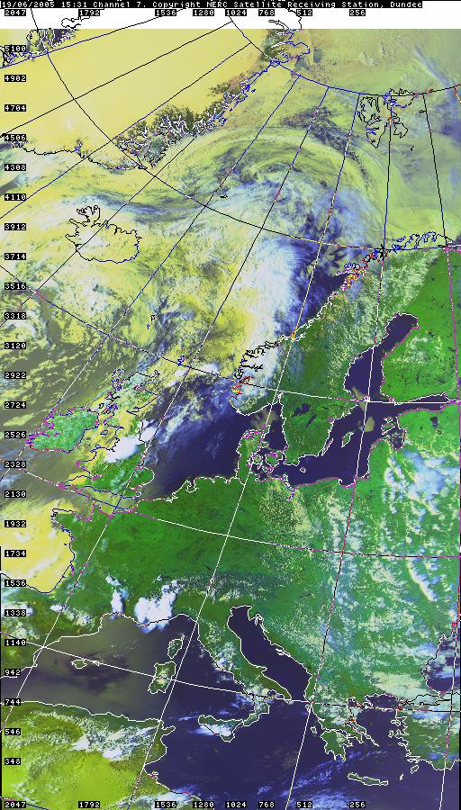
INFRARED 19.06.2005 15:31
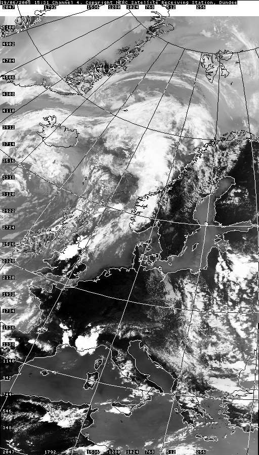
INFRARED 19.06.2005 15:31 + Grid
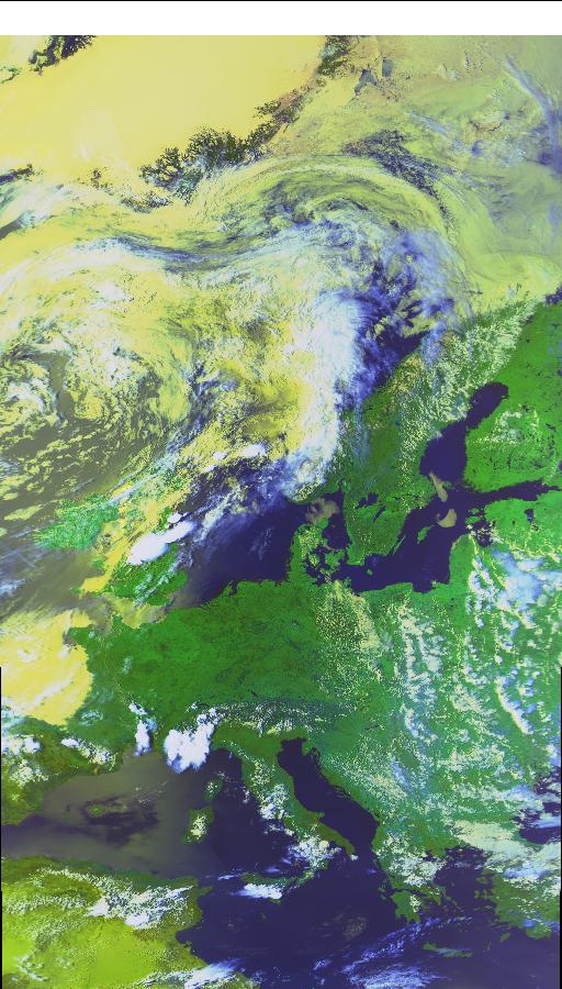
COLOUR 19.06.2005 15:31
COLOUR 19.06.2005 15:31 + Grid
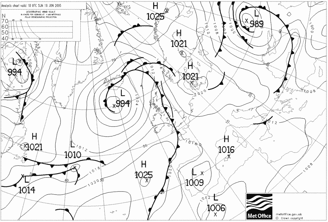
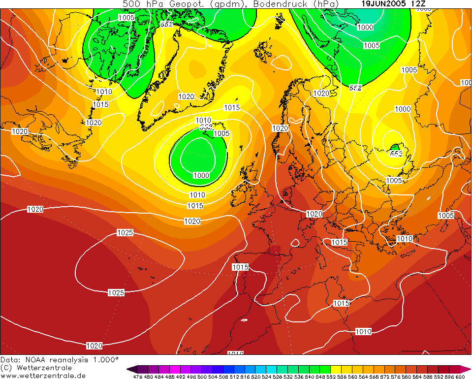
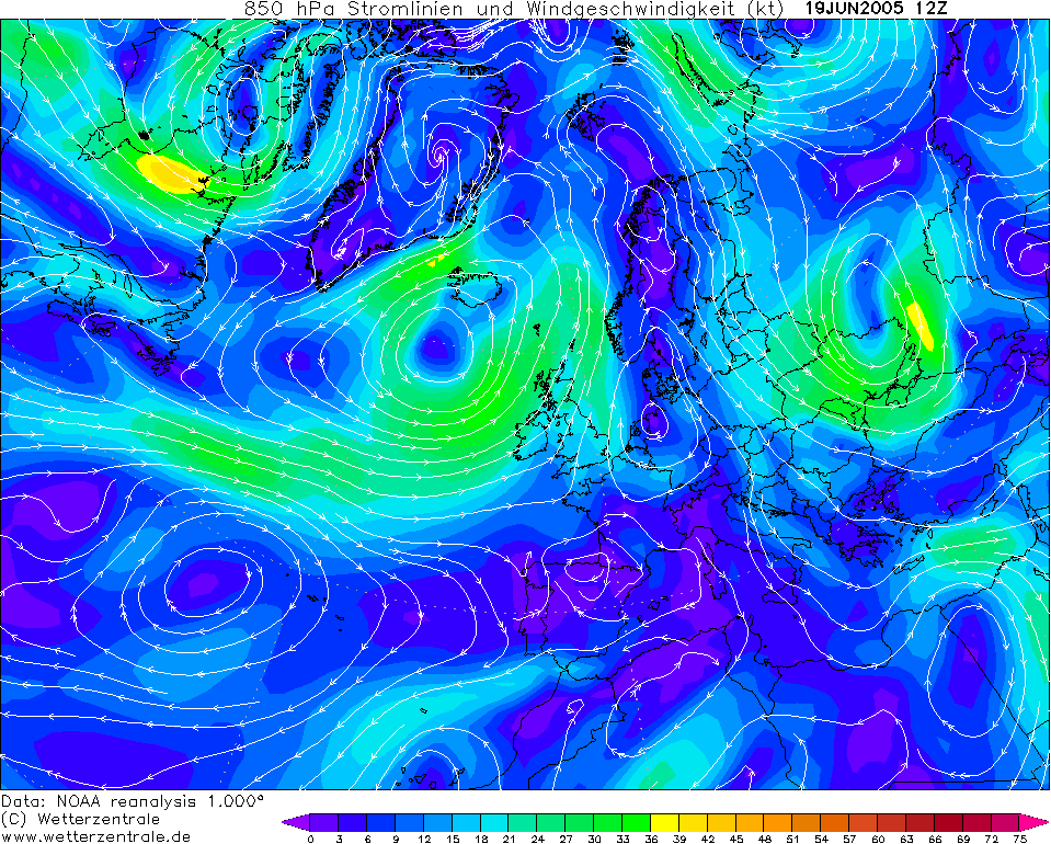
CHARTS
(Credits)

SFERICS (Credits)
|
