
![]()
|
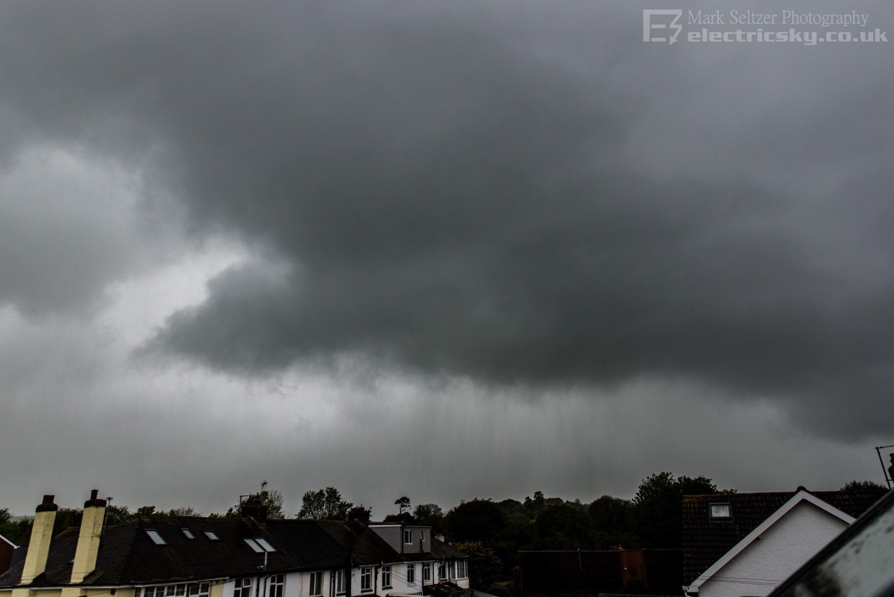
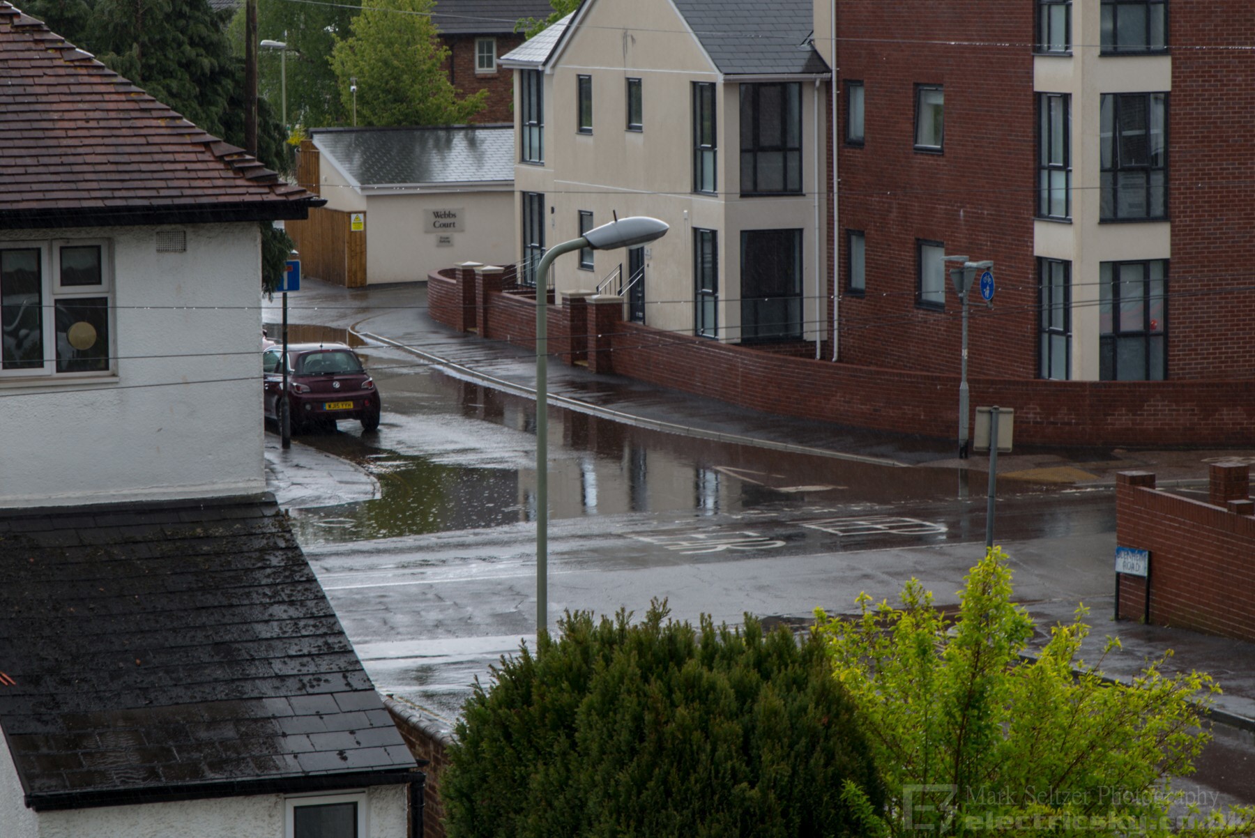
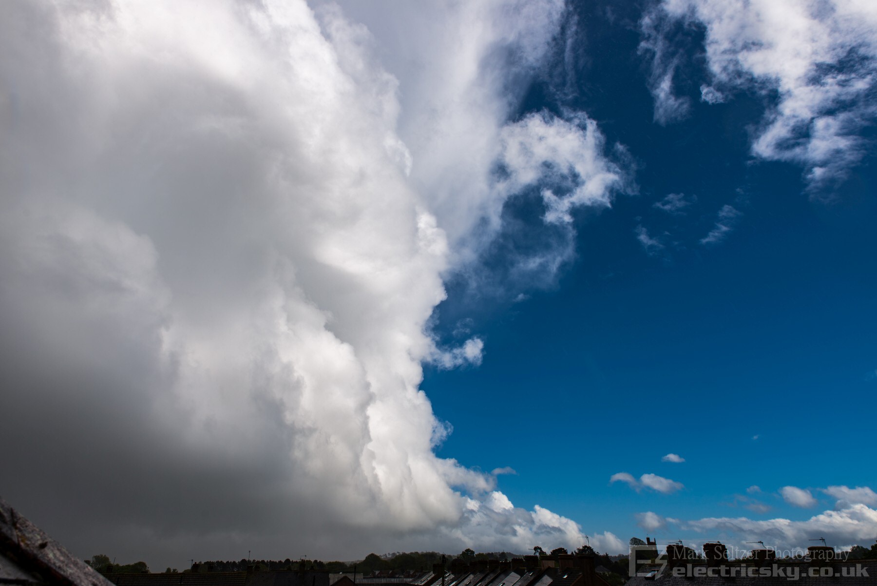
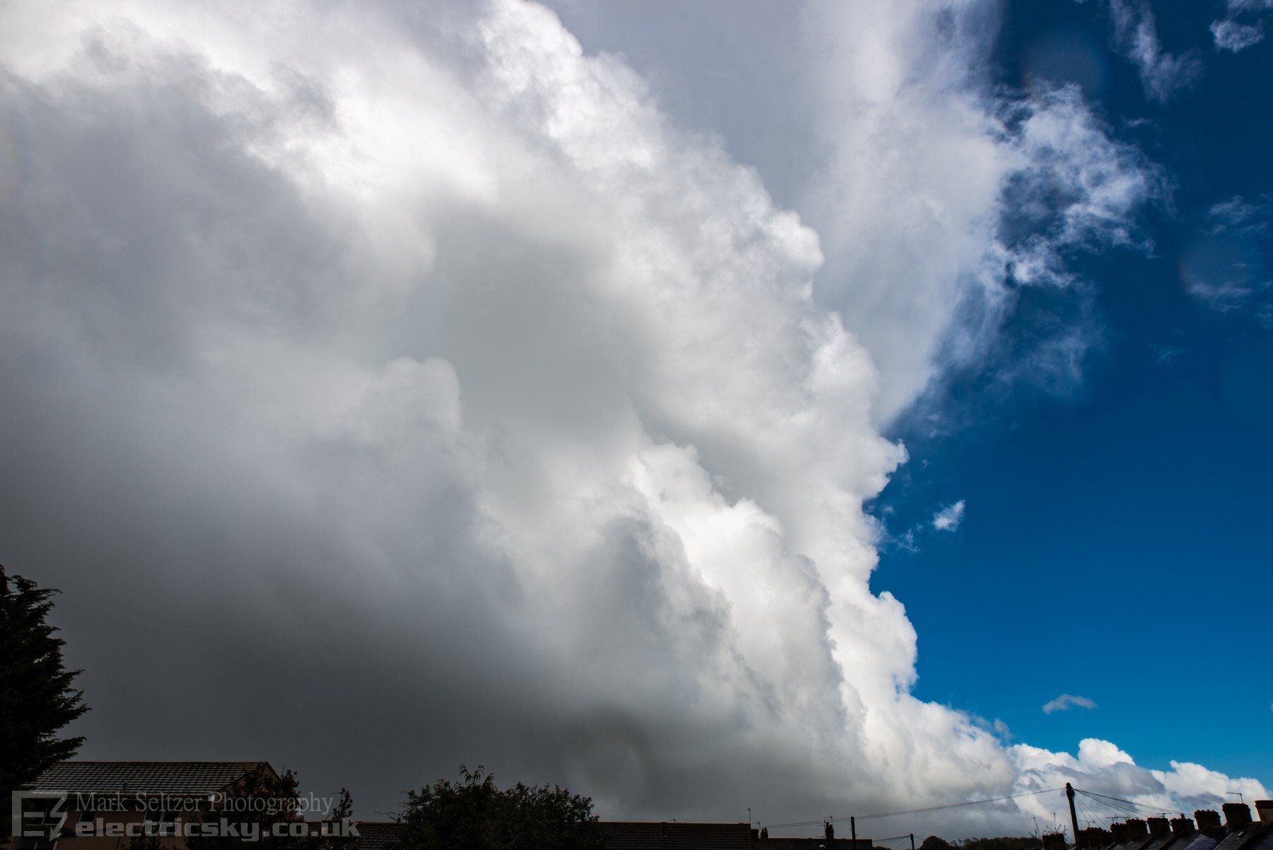
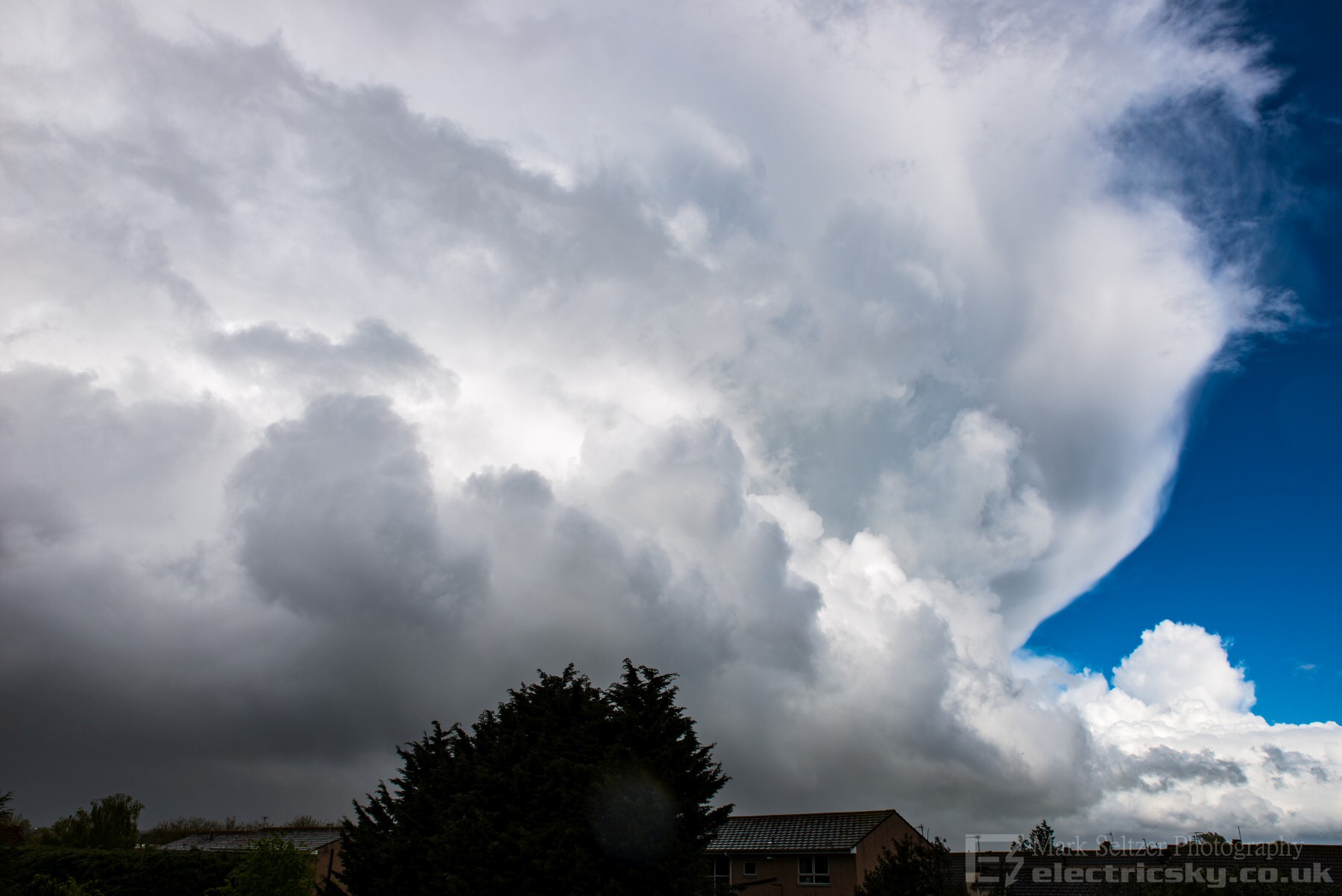
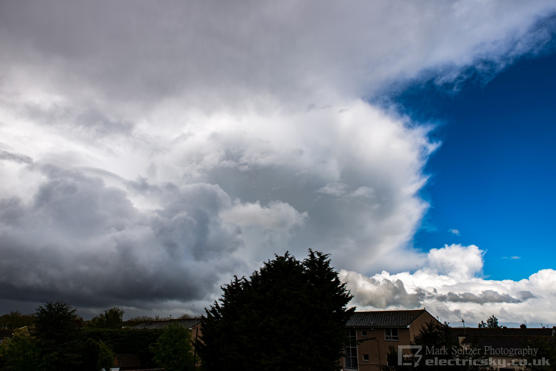
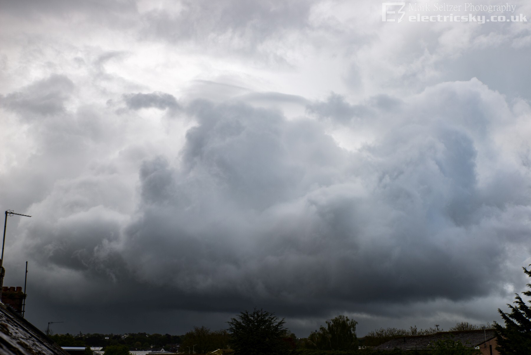
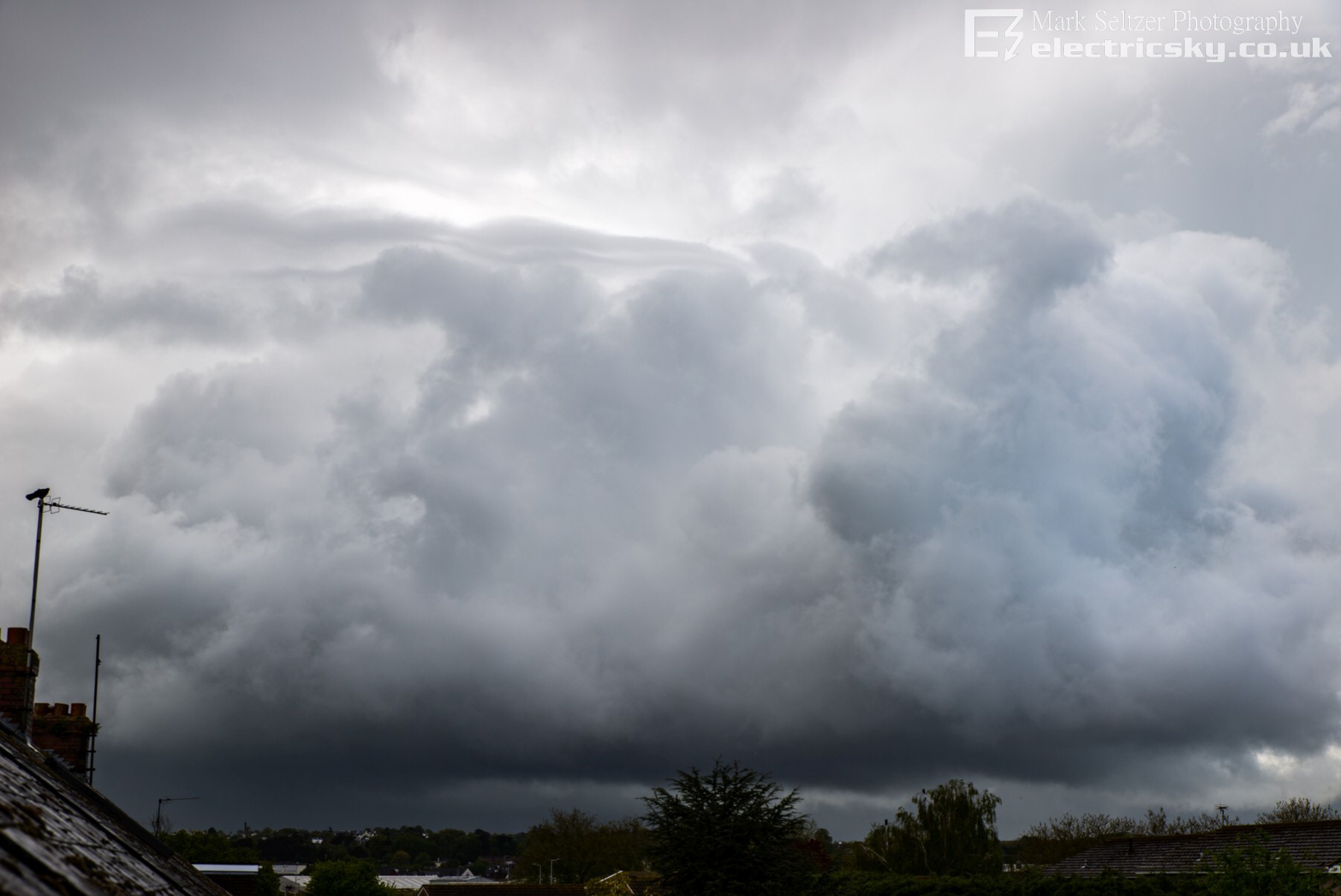
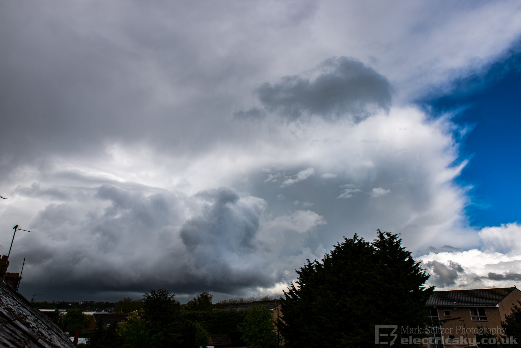
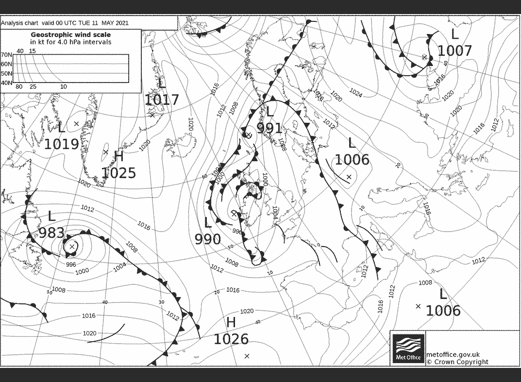
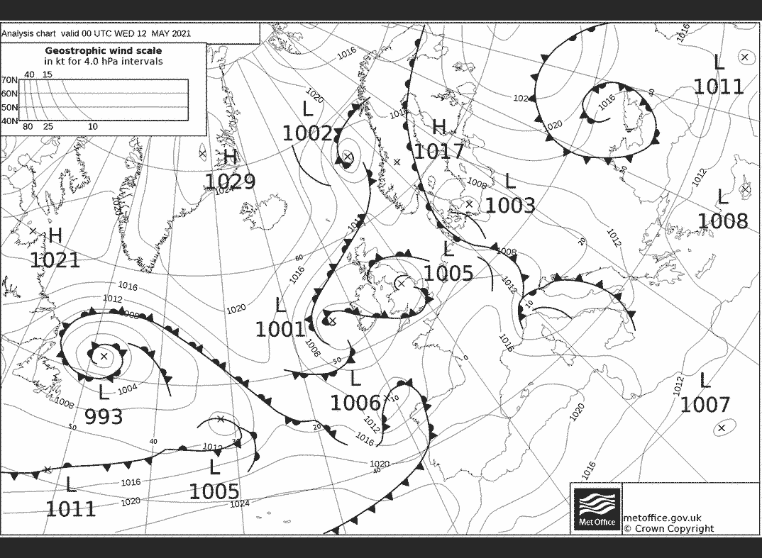
THUNDERSTORM T0119 (Supercell) An unexpected cold-air low-topped supercell approached Exeter from the southwest, riding a strong 500mb trough and perhaps co-located with the associated surface low. The trough started off across Devon and Cornwall as an old convective occlusion, semi-dynamic (frontal), before pushing northeast into south wales/Bristol, then only Northern England during the evening. Something interesting was happening on it's back edge, a lone long-lived singlecell thunderstorm which ran across southwest Devon after being born out to sea. This gave confirmed lightning strikes, and had a torrential rain core and hail (the latter reported in Newton Abbott). Distant thunders were heard from my location in Exeter so I set the kit up, but then it stopped and fell silent. However, the development didn't stop. It was likely it became too low-topped to continue the charge separation process enough to give lightning. The surface temperatures were only in the order of 8-11C, so this was a cold-air low-tropospheric affair. As it clipped Exeter and pulled away northwards (departing for Cullompton) it showed off it's impressive and well-organised CB structure. I time-lapsed it's clearance and took some photos. The timelapse revealed some impressive descending entrainments on the back edge towers (likely caused by either the rapidly descending air behind the trough, or by evaporative cooling entrainment against the drier, clearer air, or both). The marker between the very saturated low-based airmass to the cold and dry airmass behind was very defined.
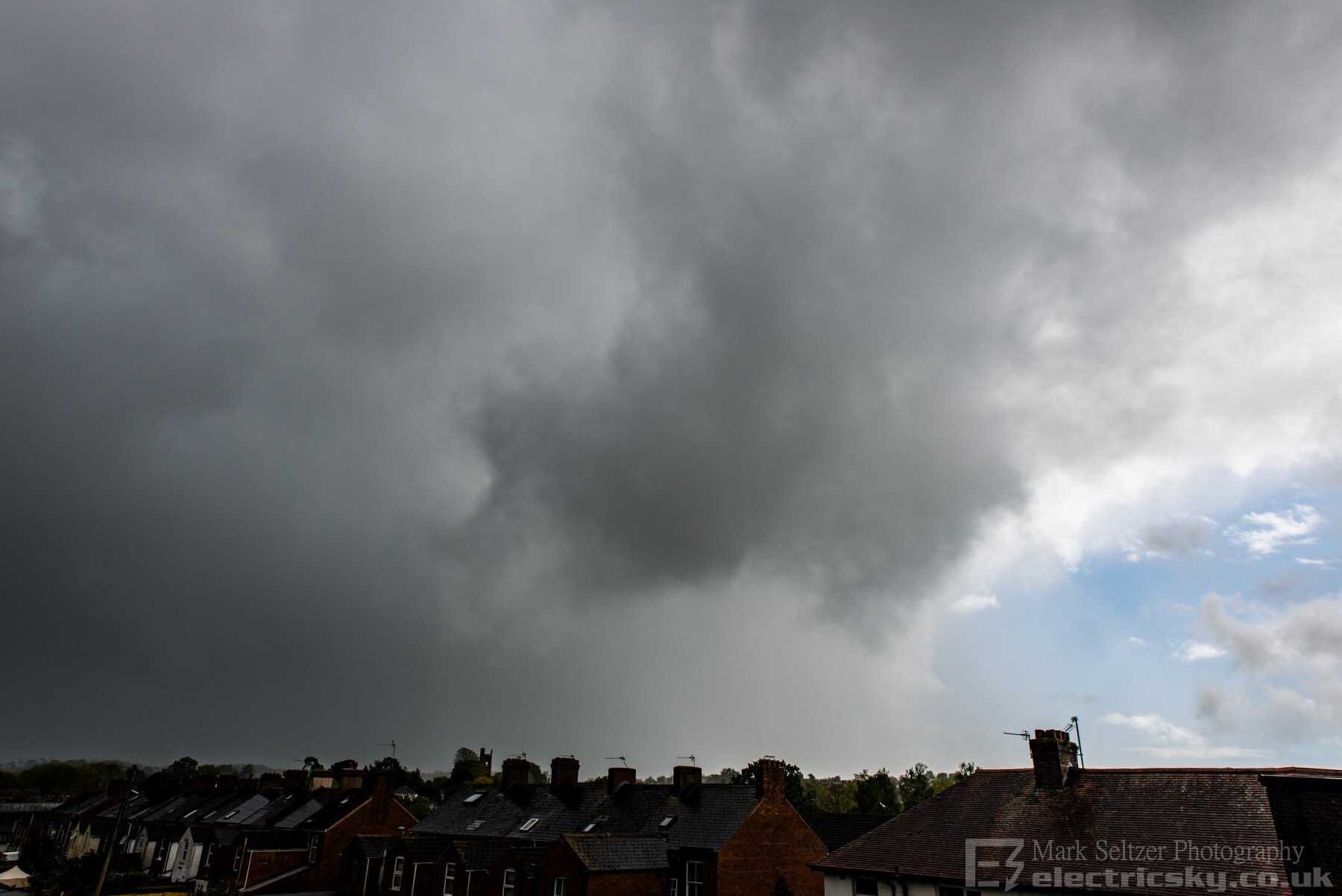
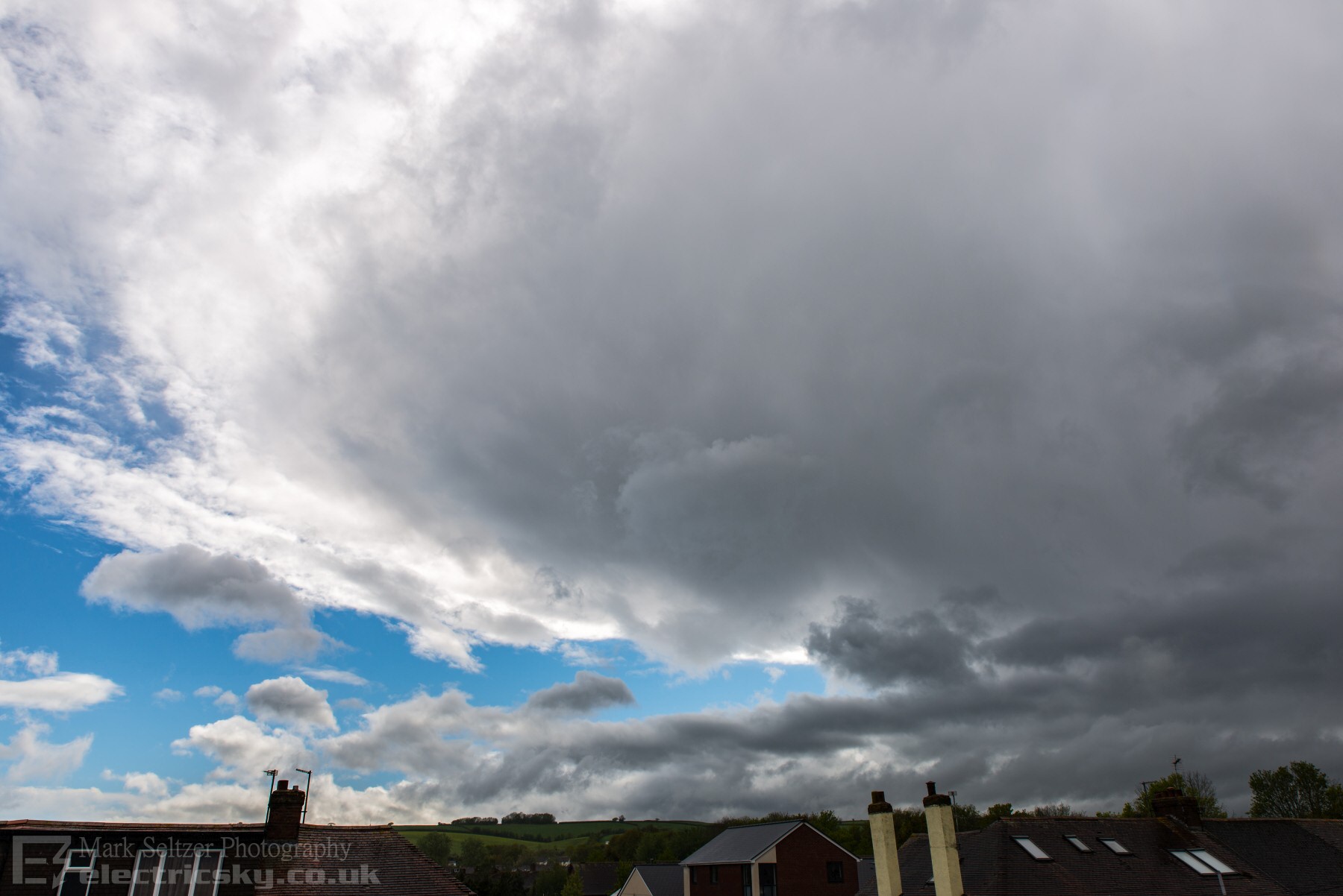
What I hadn't noticed to the left of the camera (I wasn't present at the time) looking to the NNE were some rapid and complex cloud-base movements. It looked to me like an elongated mesocyclone with occasional scud funnels, so I zoomed in with the camera. Later confirmed on doppler radar by the Met Office (public tweet), it indeed was rotating with a small hook echo evident. The strong 500mb trough, co-located surface low, RFD caused by whatever (descent or evap-cooling) must have given this singlecell enough shear to spin. And it kept spinning. There was likely tornado damage reported in several locations in Cullompton including Knightswood, and evidence of this mesocyclone in both radar and public footage continued through to Somerset and across the Bristol Channel area, still with no lightning activity, before eventually dissipating into a small vortex of ragged precipitation. This vortex was likely marking the 500mb trough and surface low continuing northwards with the jet. This trough later encouraged the impressive linear thunderstorm across Yorkshire during the evening as pre-conditioned warm air was dragged into it from the southeast. This is something you wouldn't normally expect in a cold airmass with surface temps of 8-11C, and goes to show that surface heating and cap-breaking (what you would normally associate with supercells) weren't playing here. Instead, the power of dynamic forcing, the UK is often at mercy of, was able to deliver something quite rare.
Very rough annotation below of airflow
around the low-topped mesocyclone. In the video footage you can clearly see
disorganised rotational vorticies trying to focus in the base where the wind
shear was at a maximum, perhaps in multiple locations. There is also
evidence of downdraught entrainment along the back edge of the cumulonimbus
towers (RFD, likely aided by broadscale descent behind the 500mb trough, and
perhaps rapid evaporative-cooling against the dry air).
CHARTS
(Credits)
Warren's Live Weather
|


© Mark Seltzer
www.electricsky.co.uk