
![]()
|
CUMULONIMBUS COLLAPSE WITH
GRAVITY WAVE
Summary Learning points: Arcus/roll clouds form as a result of cold wells of air from downdraughts hitting the surface and spreading out into the warm inflow. This usually means the storm cell is either dying or has stable linear structure. Not to be confused with a "Beaver Tail" in a Supercell. Impedance of the updraught usually means the updraught is forced into conditionally unstable air by surface convergence, and is more likely to result in a sudden collapse should the inflow be cut off or cease. Stratiform clouds (flat stable atmospheric clouds) can cohabit with cumulonimbus clouds (unstable atmospheric clouds) as a result of gravity waves caused by collapsing cells.
|
||
|
Environment: Impedance of updraught |
||
|
|
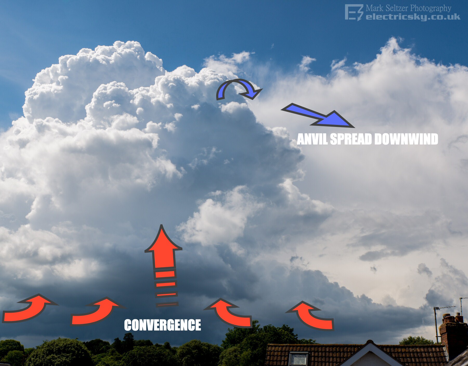
Usually, when the inflow into a cumulonimbus cuts out, the storm stops developing and the updraught column usually rises into the anvil, taking the base with it. However when there is low vertical wind shear coupled with impedance (in this case, updraught forced into slightly stable or descending air), the updraught column is more likely to collapse on itself. Surface forcing of the updraught is required to keep the tower standing, usually in the form of sea breeze convergence. Without this, the atmosphere will do it's job of suppressing free-cell convection and no cumulonimbus towers can develop. |
|
|
Sea breeze surface convergence - air forced upwards |
||
|
|
A quasi-stationary (apparently not moving) back-building cell grew over northeast
Dartmoor (Devon, UK), with the back-building side on show and the anvil
spreading away from the camera, thus giving a clear view of the updraught. Surface wind convergence, caused by a sea breeze front, forced air upwards (where wind currents meet, they can't go down into the ground, so the have to go up) and hence in the conditionally unstable airmass on this day, a cumulonimbus tower piled up. CAPE was high on this day (4 figures) but where this cell developed, vertical impedance was present in the upper atmosphere to counteract it. There was enough wind shear at tropopause height (~35,000ft) to take the very top of the tower away, but not the bulk of it, meaning most of the tower was perpetually collapsing on itself already due to the impedance. The sea breeze inflow was strong enough keep it standing. |
|
|
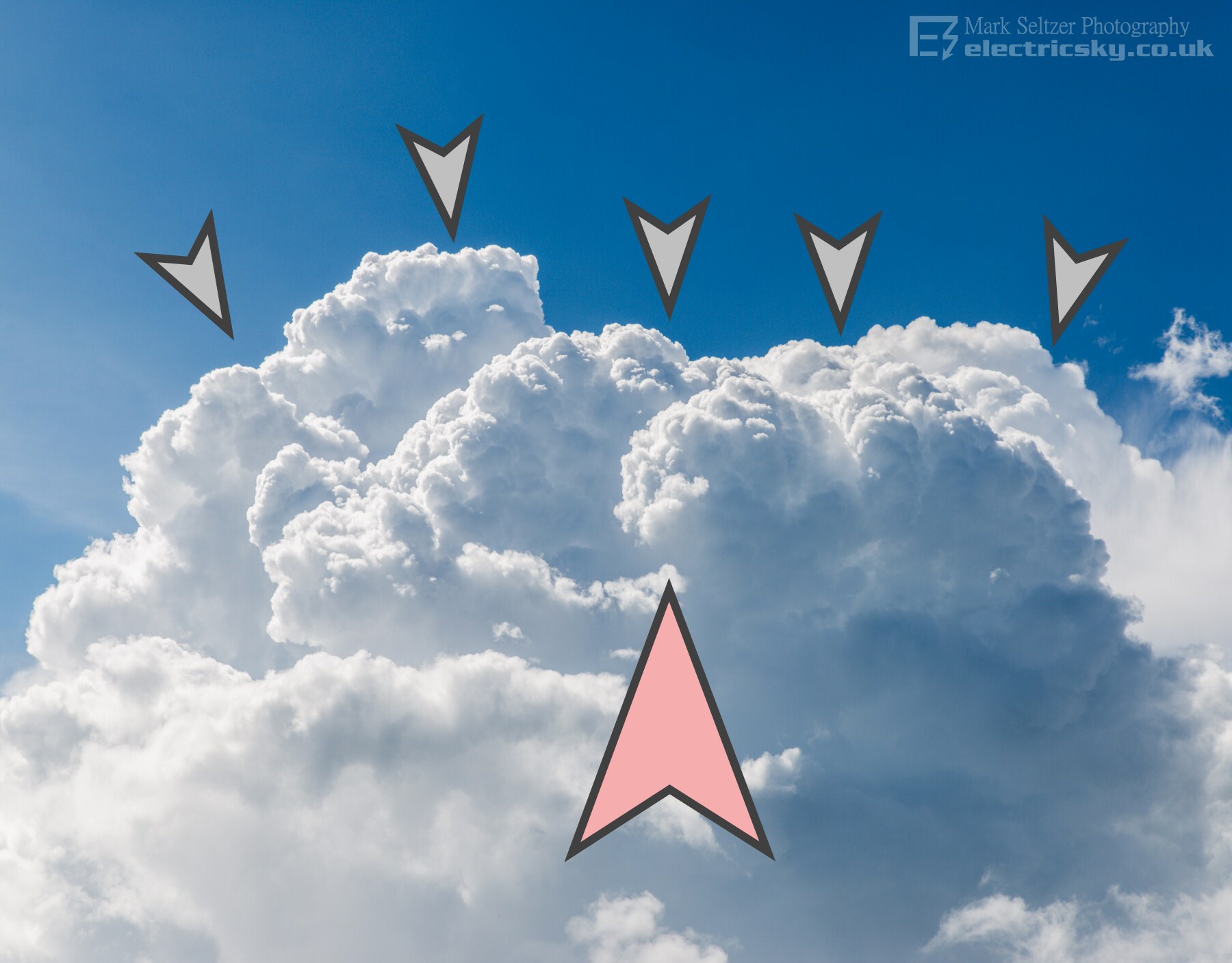
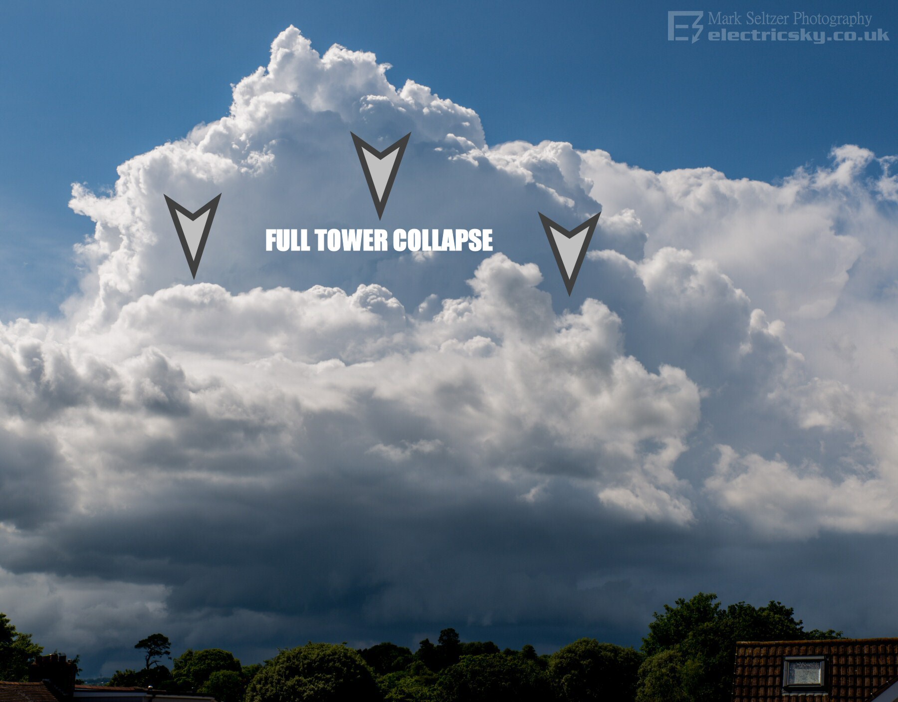
Collapse of the towers as inflow cuts off |
||
|
|
The inflow from the sea breeze convergence at the surface finally ceased, for whatever reason. With no updraught to maintain the stance of the already-struggling cumulonimbus tower, the tower completely collapsed on itself to the ground. If there was no impedance in the atmosphere, the tower would have likely continued upwards into anvil mode and the base would have lifted. DCAPE (Downward Convective Available Potential Energy) was evident here and used well. | |
|
Cold pool exhaust causes an Arcus "skirt" cloud |
||
|
|
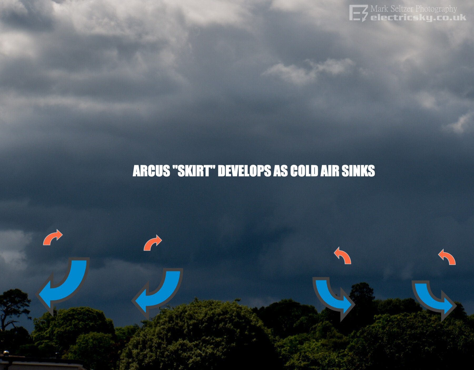
During the collapse, the invisible
cold plunge of air is revealed by an advancing (against the wind) Arcus/Roll cloud under the
parent base, sometimes mistakenly referred to as a wall cloud. This cloud
formation, which looks like a skirt, is caused by entrainment of the cooler,
damper air into the warmer boundary
layer it is pushing against, resulting in a lower cloud-base with rising or
rotary motion. These are often seen in linear or dissipating severe thunderstorms, usually because they exhibit big DCAPE values (strong heavy downdraughts). It's the same mechanism which creates a "whales mouth" formation. So it is important to note that these cloud formations are usually associated with an exhaust from, or will soon result in, a dissipating part of a thunderstorm. Chasers of supercells know when they see this, the (tornadic) show is over. Similar but, subtly different, is the "Beaver Tail" seen in severe supercells, a sign of extreme development (recycled outflow being sucked back up into the storm). |
|
|
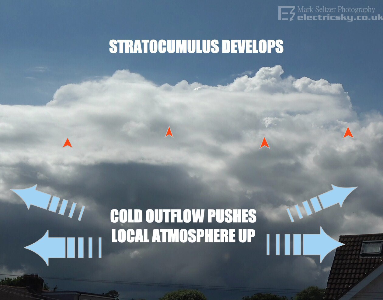
Gravity Wave pushes local atmosphere upwards |
||
|
|
Back to this storm... the cold pool
also pushed the surrounding
environmental air upwards, rather like a tsunami, causing water vapour in
the middle atmosphere to condensate and clouds to
form again in stratiform layers.
Note that very little of this forced cloud resulted in towering cumuloform cloud,
showing the near-stable environmental conditions within the prevailing airmass itself. This whole sequence shows how the atmosphere behaves as a fluid, and how cumulonimbus clouds can alter the surrounding environment in an unpredictable way. I personally always wondered why you sometimes see Alto or Stratocumulus sheets around cumulonimbus fields, and from observing this collapse I not better understand how stratiform clouds can form in a seemingly unstable atmosphere. |
|
© Mark Seltzer
www.electricsky.co.uk