
![]()
|
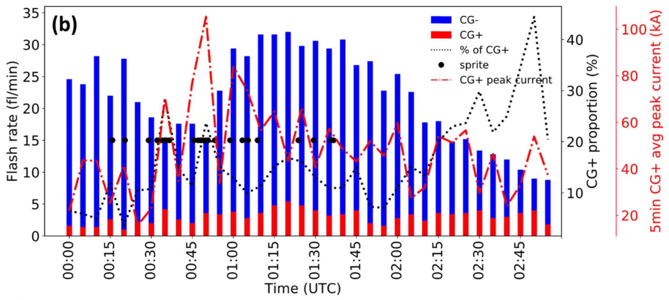
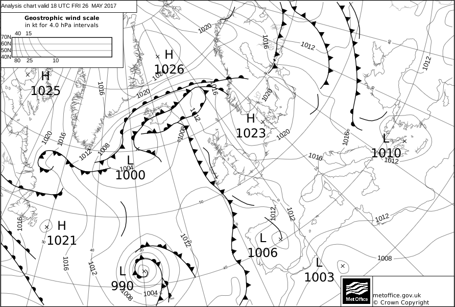
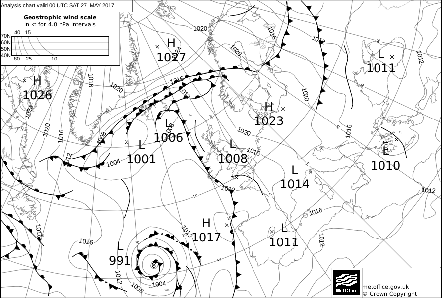
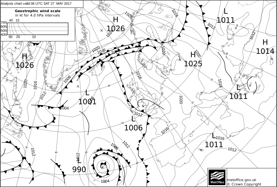
THUNDERSTORM T0106 This was one of the most significant lightshows the southwest has seen in recent years. I haven't seen this frequency of lightning since being in the US. The initial MCS developed off the coast of Plymouth and swept north and spread in an arc across Cornwall, Devon, then eventually Dorset, Somerset and into South Wales during the early hours of the 27th. Most of the lightning was high-level intra-cloud, often in call-and-response with other towers, and the environment was relatively dry enabling clear view of the towers which are quite often obscured in these continental plume situations. The upper-level nature of the lightning with low-CG count meant that the thunder was relatively quiet and ambient. There were a few positive CGs however, one of which reached 170kA (see scientific paper below). Not only this, but 23 sprites were observed from the UK Meteor Network. Plymouth saw nearly continuous 1-4 second discharge rates, mostly up in the cloud with the odd ground strike, and occasionally less than 0.5s discharge rates (gleaned from Youtube footage).
Here in Exeter, I arrived late to the
scene just in time for overhead passage. I shot video looking west-northwest
where the bulk of the MCS was developing. In the video, it looks time-lapsed,
but it isn't (apart from the montage at the
beginning). Mature cells weren't quite overhead, but were developing with
some early tower flashes and sparse drops of large rain. The lightning
remained mostly upper-level, often in "call and response" between different
towers, almost giving the impression there was intelligent life up there and
casual chatter. There was no Saharan dust present either, where Saharan dust is thought to enhance lightning rates through giving more cloud condensation nuclei to the atmosphere and thus offering more ice particles to charge. One environmental aspect that may have been favourable was the low vertical wind shear through the column. Normally this would not be a favourable severe storm condition and can kill cells as they form, but as the forcing was so strong below and seemingly independent of downdraughts, the continual pumping of mass into the core anvil aloft perhaps allowed for very efficient dipole charging.
SCIENTIFIC PAPER ON THIS STORM
BY UNIVERSITY OF BATH
UK METEOR NETWORK SPRITES
PUBLIC FOOTAGE/NEWS
|
© Mark Seltzer
www.electricsky.co.uk