Storm Log
Content may be of sample quality for web-viewing and are copyright
Mark Seltzer.
Full resolution images and
video are held offline. Please
contact
if you wish to use any footage.
HIGHLIGHTS
(Full log further
down)
Full Chases
T0133
11-06-23 Oxon to Wiltshire UK - "It will take more than 1500J of
CAPE to get me out of Devon"
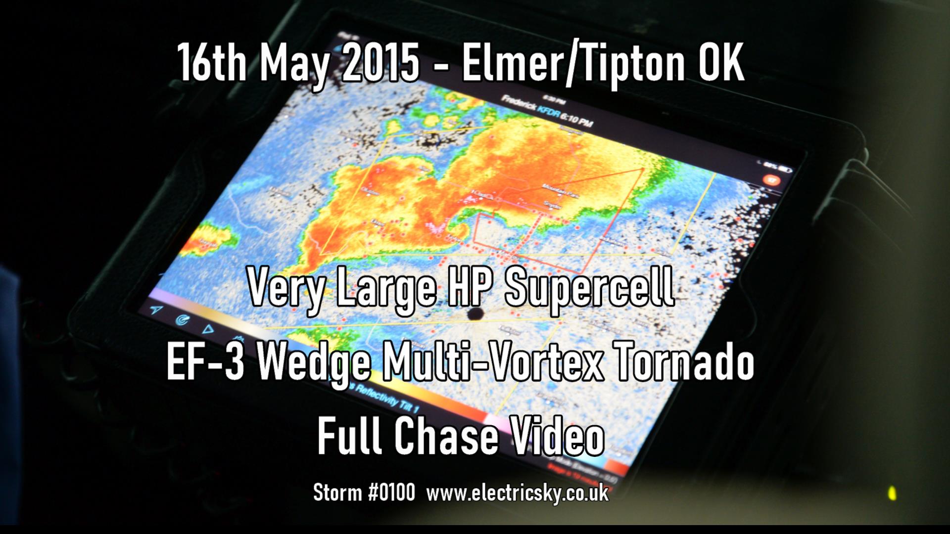
T0100 16-05-15
Elmer, Oklahoma USA - TIPTON/ELMER SUPERCELL and EF3 WEDGE
(coming soon) T0097
09-05-15 Red River, SW Oklahoma/N Texas, USA - Tornadic supercell,
missed the tornado trying to cross the river.
T0088 10-05-14 Wellington, Kansas USA - Weak single cell storm
with superb anvil
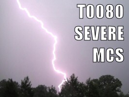
T0080
12-05-11 Oklahoma, Sallisaw, USA - Huge squall line MCS that just
kept giving.
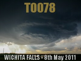
T0078 08-05-11 Wichita Falls, NW Texas, USA - Low precip, high
based, huge CAPE dryline multicell.
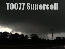
T0077
01-05-11 NE Texas, USA - Isolated rotating supercell with
dangerous positive C-G lightning.
T0075 23-04-11 Tiverton, Devon UK - Isolated high-CAPE
singlecell
Biggest Lightning
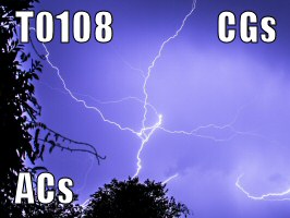
T0108
18-07-2017 Exeter, Devon UK - Following T0107, Exeter's best lightshow for years
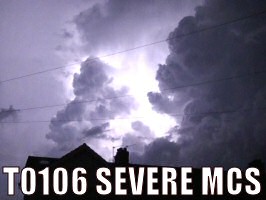
T0106
27-05-2017 Exeter, Devon UK - Very frequent lightning from a
notable severe MCS
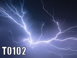
T0102
19-05-2015
Norman, Oklahoma USA - rearward sloping
squall, biggest AC and GC strikes
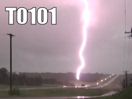
T0101 19-05-15
Newcastle, Oklahoma USA - Brief Close-up CG Lightning
Barrage
T0099
15-05-15 Norman, Oklahoma USA - Powerful rearward
sloping linear squall, much AC and GC lightning
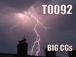
T0092
17-07-14 Exeter, Devon UK - Strong distant thunderstorm
with huge C-G
T0080
12-05-11 Oklahoma, Sallisaw, USA - Huge squall line MCS that just
kept giving.
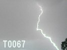
T0067
21-10-06 Macclesfield UK - Another late thunderstorm with
beautiful cloud formations
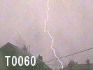
T0060
12-06-06 Macclesfield UK - Active C-G striker directly overhead
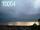
T0054 18-08-04 Macclesfield UK -
Proceeding T0053, a photogenic & active cell
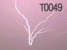
T0049 07-07-04 Macclesfield
UK - Highly active
and loud night-time C-C
producer
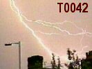
T0042 02-06-02 Macclesfield
UK -
Fantastic multi-storm cluster with C-Gs
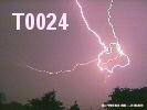
T0024 28-05-99 Macclesfield
UK - Beautiful C-C spider-lightning &
anvil-crawlers
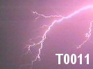
T0011 08-05-98 Macclesfield
UK - Phenomenal thunder and night-time C-Cs
PS0001 12-09-97 Macclesfield
UK - Distant isolated cell with P-Fs and C-As
Loudest Thunder
T0049 07-07-04 Macclesfield
UK - Highly active and loud night-time C-C
producer
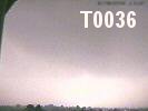
T0036 26-08-00 Macclesfield
UK - An aggressive torrential flash-storm
with close C-G
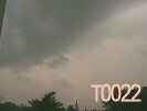
T0022 07-05-99
Macclesfield UK - Loud C-G generator (much C-G off-camera)
T0011 08-05-98 Macclesfield
UK - Phenomenal thunder and night-time C-Cs
Notable Cloud Structures
T0054 18-08-04 Macclesfield UK -
Proceeding T0053, a photogenic & active cell
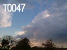
T0047 02-04-04 Macclesfield UK -
Pretty
slow-developing small cell with C-C
T0042 02-06-02 Macclesfield
UK -
Fantastic multi-storm cluster with C-Gs
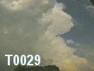
T0029 18-08-99 Macclesfield UK - Dissipating C-G storm with mushroom thunderhead
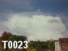
T0023 10-05-99 Macclesfield UK - Hail
shower with thunder and nuke-like development
FULL LOG
LAST
UPDATED:
07/04/2024
T####
= Thunderstorm (Vicinity) [click thumbnail or number for page] PS####
= Passing Storm (Distant) [click thumbnail or number for page] F####
= Funnel/Tornado with no lightning [click thumbnail or number
for page]
Blue Text
= Rated Storm (good
footage)
Green Text
= Funnel/Tornadic
footage
2023
PS0014
01-11-23 Exeter, Devon UK -
Isolated distant lightning from Storm Ciarán's dry intrusion
instability zone.
T0135
17-09-23 Exeter, Devon UK - Wave tip of T0134 system, major
convergence, major rain, flooding and 1 thunder.
T0134
17-09-23 Exeter, Devon UK - Very slow march of back building
night time storms, never quite got overhead.
PS0013
09-09-23 Exeter, Devon UK - Distant lightning sighted,
associated with a strong storm outbreak later.
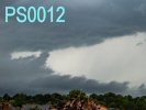
PS0012
25-06-23
Macclesfield, Cheshire UK - Thundery trough/cold front,
weakening on arrival. Large wind veer.
T0133 11-06-23 Oxon to Gloucs UK - MONSTER 1500-2000J CAPE
linear MCS birth to death. Cannon-fire CGs
T0132
11-05-23 Exeter, Devon UK - An isolated cell which developed
north Exeter. One thunder.
T0131
09-05-23 Exeter, Devon UK - Powerful cell following T0130,
dropped very close range +CGs.
T0130
09-05-23
Exeter, Devon UK - Cold-air surface convergence
CG-generator. Just skimmed Exeter.
2022
T0129
23-10-22 Exeter, Devon UK -
2nd late plume night time storm, strong CG barrage, power
disruption.
T0128
19-10-22 Exeter, Devon UK - Late plume night time storm -
frequent IC lightning.
T0127
15-08-22 Exeter, Devon UK - Strong surface-based storm
1000-1500 CAPE, rare for Exeter.
T0126
19-07-22 Exeter, Devon UK - 40C Heatwave broken by
a wave of Altocu-Cast. 1 thunder :(
PS0010
17-07-22 Exeter, Devon UK - Large Altocu-Cast gave one faint
CC to the east of Exeter.
T0125
30-06-22 Exeter, Devon UK - Followed T0124, significant
mid-Devon cell. One flash. Epic Sky.
T0124
30-06-22 Exeter, Devon UK - First decent daytime storm, 2
bouts of respectable CG
T0123
18-06-22 Exeter, Devon UK - An uncertain Mid-level storm
rolls in. One Bang.
T0122
29-05-22
Exeter, Devon UK - 180 degree low-level shear storm, insane
cloud motion, 1 CG
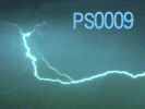
PS0009
16-05-22
Exeter, Devon UK - Long distance shots of lightning over
Dorset with some CCs
T0121
15-05-22
Exeter, Devon UK - Weak night time elevated storm rolls
overhead then dies
2021
T0120
22-08-21
North Rode, Congleton, Cheshire UK - Weak night time storm
PS0008
24-07-21
Exeter, Devon UK - Long distance shots of lightning over
Lyme Bay
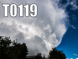
T0119
11-05-21
Exeter/Cullompton
UK - Tornadic event - Low-top supercell crosses east Devon, tornado
damage reported
2020
T0118
27-08-2020 Exeter, Devon UK - Weak cold air
storm forced by trough
T0117
13-08-2020 Exeter, Devon UK - Strong easterly
convergence storm, skirting Exeter
T0116
11-06-2020 Exeter, Devon UK - Cold air easterly
convergence storm, close CG off camera
2019
T0115
09-08-19 Exeter, Devon UK - Weak frontal
thunderstorm (embedded convection in dynamic cold front).
T0114
24-07-19 Exeter, Devon UK - Follow-up storm to T0113
along the cold front, different dynamics, distant C-G generator over Tedburn.
T0113
23-07-19 Exeter, Devon UK - Severe
Thunderstorm initial cell (widespread outbreak followed),
frequent lightning, but 99% Intra Cloud.
2018
T0112
18-07-18 Exeter, Devon UK - 3rd storm of the evening, now at
night, a little distant, following the previous two storms.
T0111
18-07-18 Exeter, Devon UK - 2nd, more intense
surface-based plume storm following the heels of T0110.
T0110
18-07-18 Exeter, Devon UK - Boisterous
surface-based plume storm, very tropical, big CB.
T0109
21-04-18 Exeter, Devon UK - An early AcCast plume storm
with some C-C action
2017
T0108
18-07-17 Exeter, Devon UK - Following T0107, Exeter's best lightshow for years
T0107 18-07-17 Exeter, Devon UK - High level AC Cast
thunderstorm
T0106
27-05-17 Exeter, Devon UK - Very frequent lightning from a
notable severe MCS
2015
T0104 10-07-15 - Exeter, Devon UK - High level AC Cast
thunderstorm with great clouds and lightning
T0103 25-05-15 - Dallas, Texas USA - Waiting at the airport, closed due
to linear thunderstorm, multiple CGs
T0102
19-05-15 -
Norman, Oklahoma USA - rearward sloping
squall, biggest AC and GC strikes
T0101
19-05-15 -
Newcastle, Oklahoma USA - Brief Close-up CG Lightning
Barrage
T0100
16-05-15
- Elmer, Oklahoma USA - TIPTON/ELMER HP SUPERCELL and EF3
WEDGE TORNADO Chase
T0099
15-05-15 - Norman, Oklahoma USA - Powerful rearward
sloping linear squall, much AC and GC lightning
T0098
10-05-15 - Norman, Oklahoma USA - Morning thundery front, isolated
ground to cloud lightning
T0097
09-05-15 - Red River, SW Oklahoma/N Texas, USA - Tornadic supercell
chase,
missed tornado trying to cross the river.
2014
T0096
16-10-14 Exeter, Devon UK - Autumn cold air thunderstorm
after dark
T0095
19-09-14 Exeter, Devon UK - Very strong isolated plume
storm with frequent distant lightning
T0094
24-07-14 Exeter, Devon UK - Strong easterly 30C sea breeze
breakdown
T0093
19-07-14 Exeter, Devon UK - Night time plume storm, then a
couple more cells during day
T0092
17-07-14 Exeter, Devon UK - Strong distant thunderstorm
with huge C-G multistrikes
T0091
17-06-14 Barcelona, Spain - Surprise thunderstorm whilst
walking down La Rambla
T0090
08-06-14 Macclesfield, Cheshire UK - Aggressive daytime
open cell convection
T0089
07-06-14 Macclesfield, Cheshire UK - Weak early morning
frontal thunderstorm
T0088
10-05-14 Wellington, Kansas USA - Weak single cell storm
with superb anvil development
T0087
07-05-14 Norman, Oklahoma USA - Night time storm
T0086
02-04-14 Exeter, Devon UK - Very early season mid-level
storm with cracking distant C-C
2012
T0083
11-08-12 - Exeter, Devon UK - Mid-level linear night time
storm
T0082
28-06-12 - Exeter, Devon UK - Mid-level linear night time storm.
T0081
14-04-12 - Exeter, Devon UK - Early easterly convergence
cell rumbles
2011
Again, with a
shortage of Spanish Plumes, southwest England was left to produce
home-grown convection, which isn't usually that good. So I went to the
states to hunt down some real storms (coinciding with one of the few
plumey events to hit SW England in May).
T0080
12-05-11 Oklahoma, Sallisaw, USA - Huge
squall line MCS that just kept giving.
T0079
10-05-11 Central E Oklahoma, USA - Frontal multicell
passing in the distance.
T0078 08-05-11 Wichita Falls, NW Texas, USA - Low precip, high
based, huge CAPE dryline multicell.
T0077 01-05-11 NE Texas, USA - Isolated rotating supercell with
dangerous positive C-G lightning.
T0076
01-05-11 Denton Texas, USA - Frontal Thunderstorm with
heavy rain.
T0075 23-04-11 Tiverton, Devon UK - Isolated high-CAPE singlecell
2008
Moved to Hampshire.
Was a very quiet year in the south with the Jet-stream sinking into
the continent (as last year)...
T0074 12-08-08 - W. Wiltshire, UK - Dramatic squall-line storm with
C-Cs
T0073
28-07-08 - W. Berkshire, UK - Heat of the day widely
destabilised air-mass
2007
Storm season kicked
off early with T0068 in March with a wintry hail shower, then.... not
a lot really. The handful of storms Macclesfield, Cheshire UK experienced this year
were weak-affairs from showers. Strong heating never took hold this
summer as the jet-stream never got that far north of the UK, so
limited fuel for monster storms. The year ended on an active note
however with T0072 producing some distant but photogenic multi-C-G
discharges.
T0072 08-07-07 Macclesfield, Cheshire UK - Multiple C-G producer seen from
a distance to the north
T0071
01-07-07 Macclesfield, Cheshire UK - A couple of C-Gs from an
isolated cell
T0070
22-06-07 Macclesfield, Cheshire UK - Odd lightning from a weakly
developing cell
T0069
31-05-07 Macclesfield, Cheshire UK - Strong but isolated convection
produces some lightning
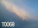
T0068 18-03-07
Macclesfield, Cheshire UK - Early electrified sleet and hail storm
2006
Plenty of storms
this year including many C-G generators. Introducing this year a
semi-professional digital video camera for T0064+. I was
unavailable to film a few of the storms but most of the bigger ones to
hit Macclesfield, Cheshire UK were documented. There was an absence of night time
storms this year which is a blow, however warm weather in October
meant the storm season extended into Autumn, an unusual occurrence for
the North West.
T0067 21-10-06 Macclesfield, Cheshire UK - Another late thunderstorm with
beautiful cloud formations
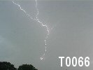
T0066
11-10-06 Macclesfield, Cheshire UK - Fairly active cold front spins up
some electrical storms
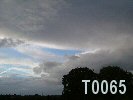
T0065
01-10-06 Macclesfield, Cheshire UK - Weakly electrified storm cell rolls
over Pennines
PS0007 11-09-06 Macclesfield, Cheshire UK - Active storm over Pennines,
Heat-Lightning observed
T0064 23-08-06 Macclesfield, Cheshire UK - A Low-centre hook produces a
torrential slow mover
T0063 20-07-06 Macclesfield, Cheshire UK - Hottest UK July day ever
(37C) fuelled this distant storm
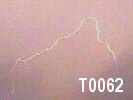
T0062
06-07-06 Macclesfield, Cheshire UK - Very loud initiation discharge
(missed) then dissipated
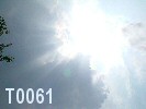
T0061
02-07-06 Macclesfield, Cheshire UK - Explosive development but steady
activity with C-Gs
T0060 12-06-06
Macclesfield, Cheshire UK - Active C-G striker directly overhead
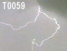
T0059
16-05-06 Macclesfield, Cheshire UK - Weakly electrified but with a few
close C-Cs
2005
Not impressed with my personal timing this year. I
missed a few exceptional storms in Macclesfield, Cheshire UK due to driving the
breadth of the country (T0055) and revelling the joys of full-time
work. Unfortunately the "storm of the year" title had to go to one
that I have no footage of, but it left its mark on much of Central
England and the news. I also missed the beginnings of T0058 which
would have proven worthy of filming if I had got to it in time after
work....sigh.
T0058
31.08.05 Macclesfield, Cheshire UK - Very large active C-G generator
(half missed)
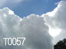
T0057
25-08-05
Macclesfield, Cheshire UK - Weakly electrified with odd discharges
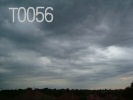
T0056 28-06-05 Macclesfield, Cheshire UK - Frontal night-time storm with
torrential rain
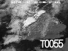
T0055 19-06-05 Macclesfield, Cheshire UK - Large heavy-duty thunderstorms
(no footage)
2004
Back on track this
year with some good storms documented. Kicking off with a picturesque
wintry cell, then some excellent night-time C-C action from a
slow-moving T0049 (in the same league as T0011 and T0024) where it's
entire lifecycle of birth and death was documented. A small shooting
vortex was then spotted in the distance with F0001, and finishing off
with another picturesque cell with a huge arcus-cloud formation
(T0054). It was almost a coin-toss between T0049 and T0054 for "storm
of the year", but T0049 won it on thunder and lightning.
T0054 18-08-04 Macclesfield, Cheshire UK - Proceeding T0053 came this active,
photogenic cell
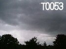
T0053 18-08-04 Macclesfield, Cheshire UK - Organised line of showers with mixed
storms
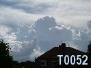
T0052
12-08-04 Macclesfield, Cheshire UK - Afternoon shower storm with big
towers and C-Gs
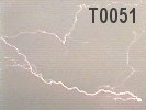
T0051
05-08-04 Macclesfield, Cheshire UK - Large but quiet storm with good C-G
and C-C
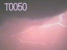
T0050 03-08-04 Macclesfield, Cheshire UK - Night-time storm with a few C-Cs
F0001 10-07-04
Macclesfield, Cheshire UK - Small shooting vortex spotted
T0049
07-07-04 Macclesfield, Cheshire UK - Highly active and loud night-time
C-C producer
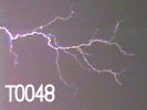
T0048 06-07-04 Macclesfield, Cheshire UK - Weakly electrified cell with one
awesome C-C
T0047
02-04-04 Macclesfield, Cheshire UK - Pretty slow-developing small cell
with C-C
2003
Minimal storms filmed this year as I was in
Reading for
much of the spring and summer studying Meteorology at Uni.
However whilst I was down there I managed to film an absolute belter
from the balcony of my hall of residence. The discharge rate was so
high the thunder was continuous for at least 5 minutes (see T0045).
T0046 17-07-2003 Macclesfield, Cheshire UK - Random discharge from a morning storm
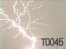
T0045
13-05-2003 Reading, Berkshire UK - Proceeding T0044 came this extremely
active cell
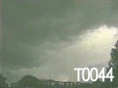
T0044 13-05-2003 Reading, Berkshire UK - Sharp showers, odd discharges here and there
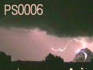
PS0006 Winter/Spring 2003 - Reading, Berkshire UK - Distant passing storm with good
lightning
2002 Another quiet year
(from my point of view anyway) as I went away for an entire month in
July and missed a few of absolute monster storms. What I did capture
was a photogenic passing storm, a strange moderate shower cell with
elongated C-C, and a cracking multiple-storm-cell cluster with some
good lightning and cloud shots.
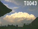
T0043 03-08-2002
Macclesfield, Cheshire UK - Weakly electrified storm with one close C-G
T0042 02-06-2002 Macclesfield, Cheshire UK - Fantastic multi-storm cluster with
C-Gs
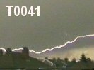
T0041 13-05-2002
Macclesfield, Cheshire UK - Moderate showers, odd discharges here and there
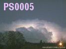
PS0005 26-02-2002
Macclesfield, Cheshire UK - Spectacular cumulonimbus lighting up like a
bulb
2001
This year seemed to
be a quiet one in the Macclesfield, Cheshire UK area. However like last year it
ended on a good storm with plenty of visible strikes.
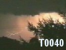
T0040
- 15-08-2001 18:29 - Macclesfield, Cheshire UK - An active C-G generator with 2
Cells
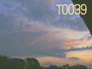
T0039 -
15-08-2001 04:00 - Macclesfield, Cheshire UK - Surprise short-lived early morning
storm with C-Cs
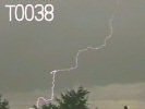
T0038 -
04-08-2001 15:17 - Macclesfield, Cheshire UK - Large updraft base creates
photogenic C-Gs
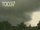
T0037 -
15-06-2001 14:16 - Macclesfield, Cheshire UK - Odd C-G discharge from a fast-moving
cell
2000
This year sees some
standard UK storm season action, nothing too spectacular. Starting off
with a few bits and bobs from local cells and ending with a vicious
evening-time C-G-rich deluge.
T0036
-
26-08-2000 19:15 - Macclesfield, Cheshire UK - An aggressive torrential flash-storm
with close C-G
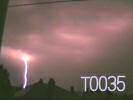
T0035 - 26-08-2000
04:00 - Macclesfield, Cheshire UK - Highly active night-time storm, similar to
T0026
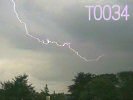
T0034 - 21-08-2000
14:00 - Macclesfield, Cheshire UK - Impressive C-Cs from a slow moving cell
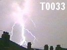
T0033 - 29-07-2000
11:00 - Macclesfield, Cheshire UK - Aggressive developer with a nice C-G strike
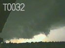
T0032 -
02-07-2000 18:20 - Macclesfield, Cheshire UK - Large updraught-base, heavy rain and
some C-Cs
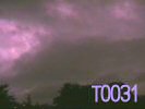
T0031 - 04-06-2000
02:03 - Macclesfield, Cheshire UK - Odd sheet lightning from a frontal storm
1999
This year sees some more
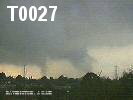
surprising action around Macclesfield, Cheshire UK; a strong mesocyclone produced
by proceeding cells of T0027, which lead to produce a multi-vortex
funnel. T0022 produced some excellent thunder from off-camera C-Gs.
Also some astonishing lightning displays from T0024, sporting long C-C
spider lightning and anvil-crawlers.
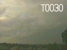
T0030 22-09-1999 - Macclesfield, Cheshire UK - Autumn cell producing some late-season activity
T0029 18-08-1999 - Macclesfield, Cheshire UK - Dissipating C-G storm with mushroom thunderhead
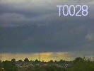
T0028 16-08-1999 - Macclesfield, Cheshire UK - Illusive dry-cell with hardy any precipitation
along base
T0027 05-08-1999 -
Macclesfield, Cheshire UK - 2 cells, one featuring a
Multi-Vortex Funnel Cloud
PS0004 02-08-1999
- Macclesfield, Cheshire UK - Distant passing storm with a C-G strike
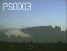
PS0003 04-06-1999 - Macclesfield, Cheshire UK - Very distant cumulonimbus lighting
up
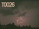
T0026 02-06-1999
- Macclesfield, Cheshire UK - Highly active (but fairly distant) night-time
storm
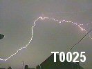
T0025 02-06-1999
- Macclesfield, Cheshire UK - Dissipating daytime C-C generator
T0024
28-05-1999 - Macclesfield, Cheshire UK - Beautiful C-C spider-lightning &
anvil-crawlers
T0023 10-05-1999
- Macclesfield, Cheshire UK - Hail shower with thunder and thunderhead
T0022 07-05-1999
- Macclesfield, Cheshire UK - Loud C-G generator (much C-G off-camera)
1998
This year sees some
great action from a variety of thunderstorm styles, including T0011
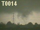
with a seriously explosive thunder. Then, T0014 revealed that it was
rotating tightly and produced a funnel cloud that appeared to touch
down briefly. T0019 gave a good hail shower and some active C-G
strikes, and T0020 and T0021 proving that lightning can still happen
in north-west England so late in the year.
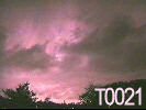
T0021
29-10-1998 Macclesfield, Cheshire UK - After-dark storm with I-C and a
Positive Flash
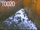
T0020 29-10-1998 Macclesfield, Cheshire UK - Late autumn shower with C-C
multi-discharge
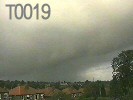
T0019 12-09-1998 Macclesfield, Cheshire UK - Active hailstorm producing C-G below arcus cloud
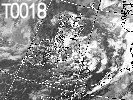
T0018 09-09-1998 Macclesfield, Cheshire UK - Torrential downpour producing C-G
(missed)
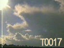
T0017 17-07-1998 Macclesfield, Cheshire UK - Passing cell with a few distant
discharges
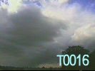
T0016 17-07-1998 Macclesfield, Cheshire UK - Weakly electrified distant cell, a
few distant thunders
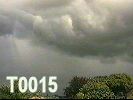
T0015 27-06-1998
Macclesfield, Cheshire UK - Weakly electrified distant cell, one C-C
discharge
T0014 15-06-1998
Macclesfield, Cheshire UK - Torrential compact Supercell
with a Funnel Cloud
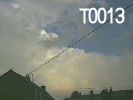
T0013
06-06-1998 Macclesfield, Cheshire UK - Follow-up cell to T0012, more
compact, low-amp C-Cs
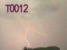
T0012 06-06-1998
Macclesfield, Cheshire UK - Torrential rain the theme of this storm -
really heavy
T0011
08-05-1998 Macclesfield, Cheshire UK - Phenomenal shockwave thunder and night-time
C-Cs
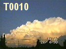
T0010 28-04-1998
Macclesfield, Cheshire UK - Illusive distant cell with incredible C-C
displays
T0009 27-04-1998
Macclesfield, Cheshire UK - Weakly developing cells, one missed C-C
PS0002
22-04-1998 Macclesfield, Cheshire UK - Very very distant cell with high
activity (no footage)
1997
The third year spotting
sees the arrival of a Hi-8 analogue video camera and some lightning
images at last, and I set out in hope of capturing some images. The
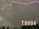
first streak I captured was from T0004, a double C-C discharge, then
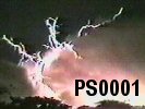
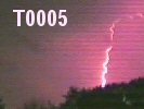
T0005 brought some night-time C-Gs. Ps0001 was a passing storm which
was quite spectacular giving a display of P-Fs and C-As.
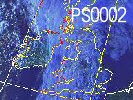
PS0001 12-09-1997 - Macclesfield, Cheshire UK - Distant isolated cell with P-Fs
and C-As
T0008 31-08-1997 - Macclesfield, Cheshire UK - Highly active but not much visible lightning
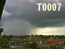
T0007 08-06-1997 - Macclesfield, Cheshire UK - Loud, very wet cell with some C-C
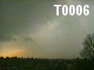
T0006 20-05-1997 - Macclesfield, Cheshire UK - Distant convectional cell cluster
with C-G
T0005 18-05-1997 - Macclesfield, Cheshire UK - Continental night-time storm with
C-G
T0004 10-05-1997 - Macclesfield, Cheshire UK - First video of a storm with first
C-C shot
1996 The second year of storm spotting also, unfortunately, involved my
tape recorder. The first major storm was T0002 which had a total
active duration in Macclesfield, Cheshire UK of over 3 hours consisting of multiple
cells. I audio recorded this storm and still have some of the good
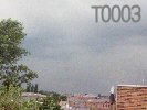
thunder on cassette (now converted to MP3). The second storm T0003 was
an active daytime C-G generator. Again, no footage or audio recordings
were retained apart from a photo of the cloud-base in the distance.
T0003 23-08-1996 - Macclesfield, Cheshire UK - Distant active C-G generator (no footage)
T0002 07-06-1996 -
Macclesfield, Cheshire UK - Highly active night-time storm (audio-taped)
1995
First year of storm spotting, however without a video camera (as I
was only 12 years old) I was limited to using a tape recorder!
Previously I would be glued to the window during any storm,
until one day I started trying to document the thunder. I only ended up taping one storm for 1995
(T0001), however I no longer have the tape and don't have any audio
samples to offer. I still logged it as T0001 and so it debuts the
beginning of the storm log.
T0001 24-05-1995 - Macclesfield, Cheshire UK - Weakly electrified cell